Fuerteventura Road Trip from North to South: Corralejo Dunes, Betancuria and Jandía in 3 Days
A 269 km drive from Fuerteventura Airport in three days — the Corralejo dunes and the island of Lobos, La Oliva and the sacred mountain of Tindaya, the old capital Betancuria on the FV-30, Pájara, the caves of Ajuy, Costa Calma, Sotavento and Morro Jable on the Jandía peninsula.
Rough estimate — fuel + nights at typical rates. Get an exact figure in the calculator.
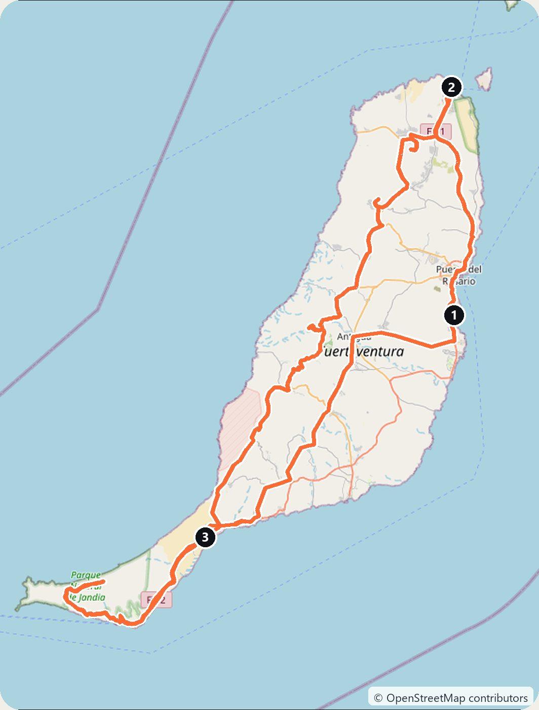
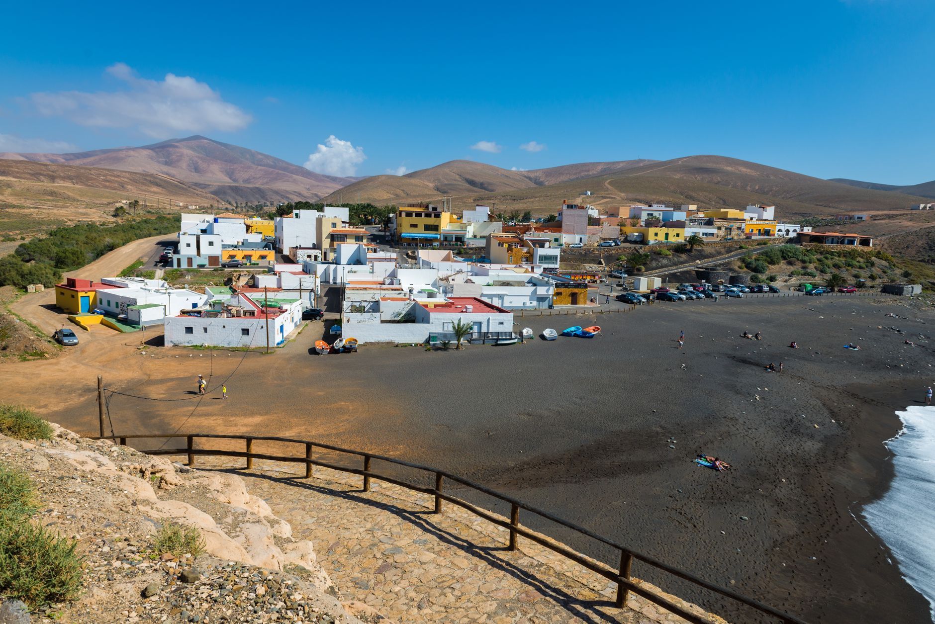
Fuerteventura is the long, dry island of the Canaries: a landscape of sand, bare brown mountains and pale beaches that run for kilometres. This drive takes it from top to bottom. It starts at Fuerteventura Airport, just outside Puerto del Rosario, where you rent the car, runs north to the dunes of Corralejo and the small island of Lobos, then down through the old villages of the interior, La Oliva, Betancuria and Pájara, to the west coast at Ajuy, and on to the beaches of the south and the Jandía peninsula. It makes about 269 km in three days.
The Canary Islands are part of Spain, so you drive on the right. Distances are short and the main roads are good, and the island is a year-round drive. Two things are worth knowing before you go. Landing on Lobos needs a free permit from the island council, booked online, as well as a boat ticket. And the famous beach of Cofete lies at the end of a long dirt track that most rental contracts do not allow you to drive; more on that on Day 3.
Day 1 — Fuerteventura Airport to Corralejo (40 km)
Pick up the car at Fuerteventura Airport and drive north on the FV-2 and the FV-1. Near the end of the drive the road runs straight through the Corralejo Natural Park, a field of white dunes on the island’s north-east coast. The sand is of marine origin, and the wind pushes it across old lava flows from the Bayuyo eruption as far as Montaña Roja (312 m). The beaches along the road are known as the Grandes Playas. Park only in the marked places: in the natural park, vehicles are not allowed off the authorised roads and tracks, and you walk on the marked paths.
Continue into Corralejo, the fishing port turned resort at the northern tip of the island, and spend the rest of the day on Lobos, about 2 km offshore. The island is named after the monk seals, lobos marinos, that once lived on its shores. European explorers and settlers hunted them for their skins and fat from the 14th century on, and none live on the island today. It is a natural park, and its highest point is the crater of La Caldera (127 m); the Punta Martiño lighthouse at the northern tip was first lit in 1865.
To land on Lobos you need an authorisation from the Cabildo de Fuerteventura, the island council, booked at lobospass.com. It is separate from the boat ticket. Visitors come in two shifts of 200 people, from 10:00 to 14:00 and from 14:00 to 18:00; one boat operator says requests open 3 days before your date, with up to 3 people per request. Book the permit before the boat. Passenger boats leave from Corralejo harbour; from 11 September to 13 June the Ferry Lobos timetable lists departures at 9:45, 11:00, 12:30 and 13:30, with boats back at 14:00, 16:15 and 17:15. If you have the evening free, El Cotillo, about 20 km west of Corralejo, is a fishing village known for its sunsets, with the restored Castillo del Tostón tower by the harbour. Sleep in Corralejo.
Day 2 — Corralejo to Costa Calma via Betancuria (118 km)
Drive south-west to La Oliva. The Casa de los Coroneles, the 18th-century house of the colonels who once held military power over the island, is the village’s landmark; its official website says it is closed to visits for rehabilitation, so see it from outside.
A few kilometres west rises Montaña de Tindaya (400 m), the sacred mountain of the island’s original people, the Majos, who carved footprint engravings at the summit. It is a natural monument and a protected cultural site, and climbing it without an authorisation is forbidden; in 2025 the Guardia Civil reported a visitor who did. Look at it from the road. South of the village, on the slope of Montaña Quemada, stands the monument to the writer Miguel de Unamuno, exiled to Fuerteventura in 1924 by the dictator Primo de Rivera; the statue is by Juan Borges.
Head south into the mountains and pick up the FV-30, the old mountain road through the Betancuria Rural Park. Before the descent into Betancuria, the Guise and Ayose viewpoint shows two statues of the island’s aboriginal kings. The Morro Velosa viewpoint nearby, designed by César Manrique, has been closed for rebuilding since works began in September 2025; the Cabildo expects them to be finished before the end of 2026.
Betancuria sits in a valley below. It was founded in 1404 by the Norman conqueror Jean de Béthencourt and was the island’s capital until 1834. Its church of Santa María was destroyed in a Berber raid in 1593 and rebuilt. Continue south on the FV-30 to Vega de Río Palmas, where the church holds the figure of the Virgen de la Peña, the island’s patron saint, then on past the Las Peñitas reservoir, built between 1939 and 1943 and since silted up, down to Pájara. Its church of Nuestra Señora de Regla has a carved stone portal of suns, snakes and big cats that is often compared to Aztec art.
From Pájara take the FV-621 to the coast at Ajuy, a small fishing village on a black-sand beach. The Ajuy Natural Monument holds the oldest rocks in the Canary Islands: sediments laid down on the ocean floor more than 100 million years ago. A path leads from the north end of the beach along the cliffs to the caves of Ajuy; the old limekilns recall the time when lime was shipped from here to the other islands. The Cabildo asks you to keep to the paths and take care near the cliff edges, and the access has been closed during strong winds. Then drive south on the FV-605 and the FV-2 to Costa Calma for the night.
Day 3 — Costa Calma to Fuerteventura Airport via Morro Jable (111 km)
Follow the FV-2 south to Morro Jable, the last town on the Jandía peninsula, with a long beach and a lighthouse on the seafront. Behind it rise the mountains of the Jandía Natural Park, topped by Pico de la Zarza (807 m), the highest point of Fuerteventura.
On the other side of those mountains is Cofete: a wild beach of about 14 km, a handful of houses and the Villa Winter, built between 1946 and 1954 by the German engineer Gustav Winter and the subject of many legends. The way there from Morro Jable is about 20 km, most of it unpaved track. Say it plainly: most rental contracts do not allow it. AutoReisen’s terms, for example, forbid driving on unsurfaced roads, and its insurance does not cover driving off-road; one local rental company says that no rental company in the Canaries covers damage on unpaved roads. If you want to see Cofete, take public bus line 111 (Morro Jable – Cofete – Punta de Jandía), run by Tiadhe, or a guided 4×4 tour from Morro Jable, and check the timetable before you go. The trip there and back is not counted in the 111 km.
On the way back north, stop at the Sotavento viewpoint above the Playas de Sotavento east of Costa Calma. On Playa de la Barca below, the Windsurf and Wingfoil World Cup has been held since 1986, most recently from 17 July to 1 August 2026. Then drive back north to Fuerteventura Airport. Shortly before the airport the FV-2 passes Caleta de Fuste, a resort with an 18th-century coastal tower, a small marina and golf courses, a good last stop or a base for an extra night.
Costs
Use the cost calculator to price fuel and nights for your dates. Spain has no vignette, and there are no toll roads on Fuerteventura, so the whole drive costs nothing in road charges.
Budget for accommodation, fuel for about 269 km, car rental, and the boat to Lobos: Ferry Lobos charges €17 return for an adult and €11 for a child aged 4 to 11, including taxes, insurance and port fees. The Lobos permit itself is free for now; the Cabildo has said it plans to bring in an access fee. If you go to Cofete, add the bus fare or the price of a 4×4 tour. Read your rental contract for the rules on unpaved roads before you leave the tarmac anywhere on the island.
This trip is also in the free Roadcut trip planner: change the number of days and where you sleep each night, pick your vehicle to see the fuel cost, check the weather on the road, and open each day in Google Maps, Apple Maps or Waze.
Where to stay on this route
Night by night, in the towns this itinerary sleeps in.
- Night 1Hotels in Corralejo →
- Night 2Hotels in Costa Calma →
The search opens with sample dates a month from today — change them to yours on Booking. Affiliate link — we may earn a commission at no extra cost to you.
The route on video
Get this itinerary by email
The days and the nights in your inbox, with a link back here when you are ready to book.
We use your address only to send this itinerary, unless you tick the box. Privacy
⚡ By electric car on this route
41 charging stations within 1.5 km of the road, 23 of them fast (DC). Most powerful: 100 kW.
Longest stretch without a fast charger tagged: 60 km, from km 152 of the route.
According to OpenStreetMap and operators’ websites. Fast = a DC plug or 50 kW and more; not every station has its power filled in, so there may be more. Power and stations missing from OpenStreetMap also from DGT / MITERD — nap.dgt.es (CC BY). See them on the planner map → · EV charging →
🚦 Know before you go
Tolls · Ferries · Good to know
Tolls. Spain has no vignette and there are no toll roads on Fuerteventura, so every FV road on this route is free.
Ferries. No car ferry is needed. Passenger boats run from Corralejo harbour to the island of Lobos, about 2 km offshore. Landing there needs an authorisation from the Cabildo de Fuerteventura, booked at lobospass.com and separate from the boat ticket; visitors come in two shifts of 200 people, 10:00–14:00 and 14:00–18:00. From 11 September to 13 June the Ferry Lobos boats leave Corralejo at 9:45, 11:00, 12:30 and 13:30 and come back at 14:00, 16:15 and 17:15; an adult return costs €17, a child aged 4–11 €11.
Good to know. The way from Morro Jable to Cofete is about 20 km, most of it unpaved track, and most rental contracts forbid or do not insure driving on unsurfaced roads — take Tiadhe bus line 111 (Morro Jable – Cofete – Punta de Jandía) or a guided 4x4 tour instead. Climbing Montaña de Tindaya without an authorisation is forbidden. The Casa de los Coroneles in La Oliva is closed to visits for rehabilitation, and the Morro Velosa viewpoint above Betancuria has been closed for rebuilding since September 2025, with works due to finish before the end of 2026. In the Corralejo Natural Park, vehicles must stay on the authorised roads and tracks.
Estimate your exact costs in the cost calculator. Prices are approximate — check official sites before you travel. Some links are affiliate links.
Plan this trip
Where to sleep
Hotels & B&Bs →Holiday homes & apartments →Campsites (bookable) →Campervan & overnight spots →Tours & tickets
Find things to do →Affiliate link — we may earn a commission at no extra cost to you.
Drive on from here
New road trips in your inbox
One email when we publish a new European route — the full guide, map and real costs. No spam, unsubscribe anytime.