Stelvio: the emperor's road over the Alps
Austria built it so its armies could reach Milan without touching Switzerland. It became a front line in 1915, a Giro legend in 1953 — and in 2025 it turned two hundred.
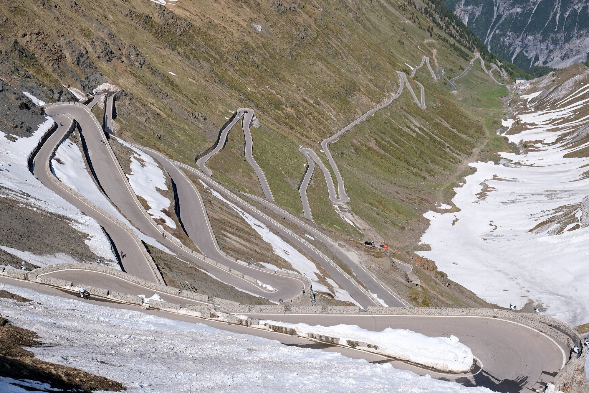
On 26 June 1820 work began on a road that the Austrian Empire wanted for one reason: to move between Milan and Vienna without crossing anybody else’s territory. After the Congress of Vienna, Lombardy belonged to the Habsburgs, but the old routes over the Alps ran through the Grisons — and the Grisons was now part of Switzerland. The answer was to go over the top, at 2,757 metres, beneath the Ortler.
Two hundred years later the Stelvio is a summer playground for cyclists, motorcyclists and people who have seen it on television. It was built as a military road, and for three and a half years of the First World War it was a front line.
An emperor’s road
The emperor Francis I decreed the road on 30 September 1817, according to Cristina Pedrana Proh, writing in the Italian trade journal Strade & Autostrade; the British magazine Top Gear, in a long piece for the road’s bicentenary, puts the decree in 1818. The man who designed it was Carlo Donegani, a senior government engineer who later became first-class engineer of the province of Sondrio. He was officially assigned the Lombard section on 14 August 1818 and handed over the complete project on 1 May 1819.
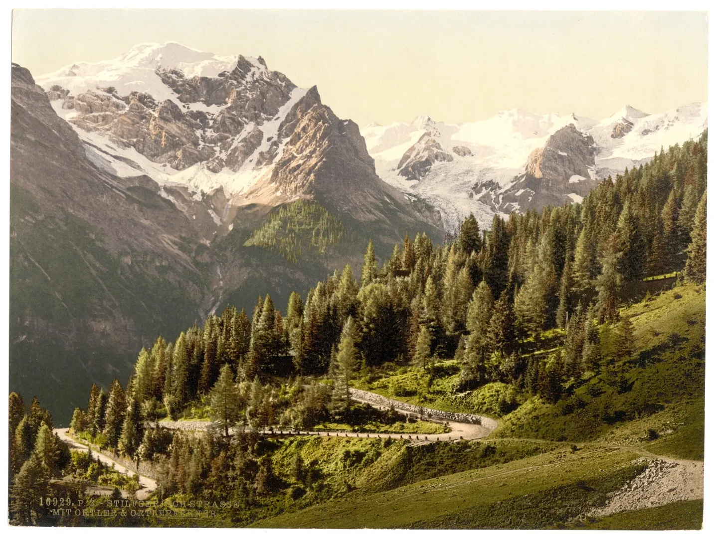
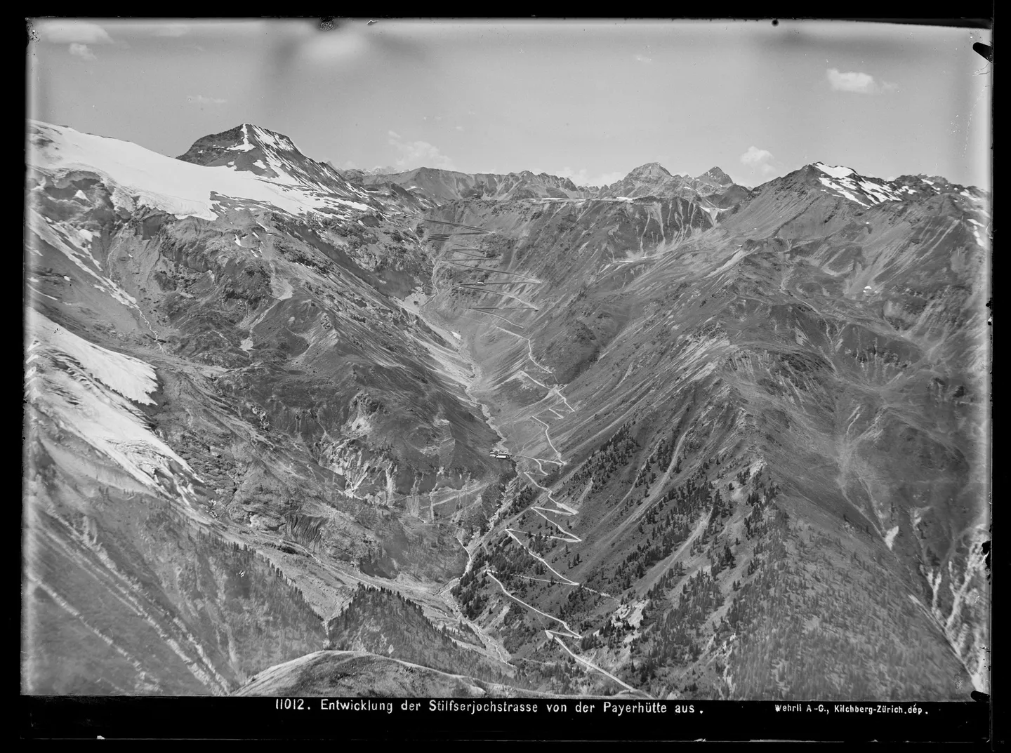
It was an army’s road, and it shows. Top Gear reports that the road was built at least 5.5 metres wide (Strade & Autostrade, working from the original project, gives 5 metres) and rarely climbs at more than 10 per cent, with its bends drawn so that gun carriages and horse teams could get round them. Donegani’s own notes, quoted by the Politecnico di Milano in an exhibition about him, called for a turning platform 14 to 16 metres across, “not less”, at each hairpin.
According to Top Gear, Donegani’s first plan for the Tyrolean side called for 61 hairpins, including a ladder of 22 straight up the cliff at the head of the valley, to keep the road away from avalanches. There was not enough rock for the retaining walls that plan needed, so the road moved onto the northern flank of the valley — fewer bends, more avalanche risk. It ended up with the 48 hairpins that are numbered today.
Building it
How many men built it depends on whom you read. A local history site from Valtellina says around 2,500 at the busiest times; Top Gear counts 1,500 labourers on the Tyrolean side alone; Strade & Autostrade describes hundreds of workers from Piedmont hired by the contractor Poli & Talacchini.
The end date is disputed too. Strade & Autostrade records the official inspection of the road in September 1824 (its biography of Donegani says 1825); the Milan newspaper Il Giorno gives the inauguration as 6 July 1825. Top Gear says the Lombard climb from Bormio was finished in 1822 and the Tyrolean side took three more years.
What is not disputed is that Donegani meant the road to stay open all year. Road workers called rotteri, living in small houses on the pass and on the Spondalunga, were to keep it clear of snow. By 1831, Il Giorno reports, a stagecoach ran from Milan: 64 hours to Bormio, 125 hours to Landeck.
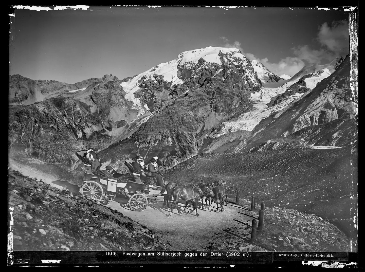
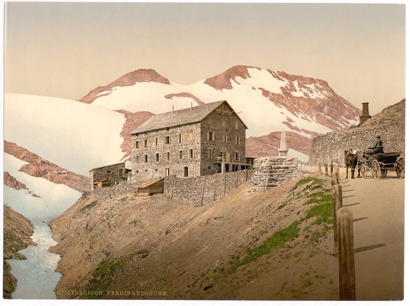
After the road came the travellers. A coach crossing of the Stelvio became part of the Grand Tour, and Top Gear describes the Grand Hotel in Trafoi at the foot of the eastern ramp as having its own orchestra and a darkroom for guests’ photographs. At the top stood the Hotel Ferdinandshöhe.
The front line
In 1914 the pass sat where Austria-Hungary, Italy and neutral Switzerland met. When Italy entered the war in May 1915, the front line began here, at the Ortler–Cevedale massif.
On 4 June 1915, according to the Swiss association that looks after the wartime positions, Austrian artillery shelled Monte Scorluzzo, the summit of about 3,090 metres that looks down on the pass. The Italians withdrew, and the gendarmerie captain Andreas Steiner and about forty men, in three groups, occupied it without a fight. It stayed in Austrian hands until the end of the war. Swiss soldiers held a post on the Umbrail.
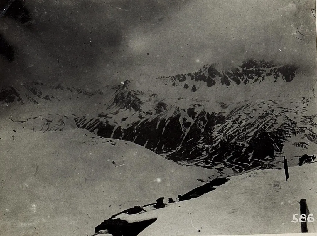
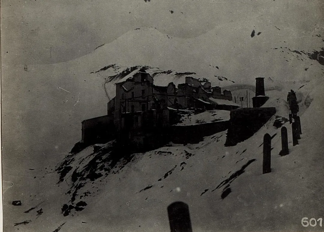
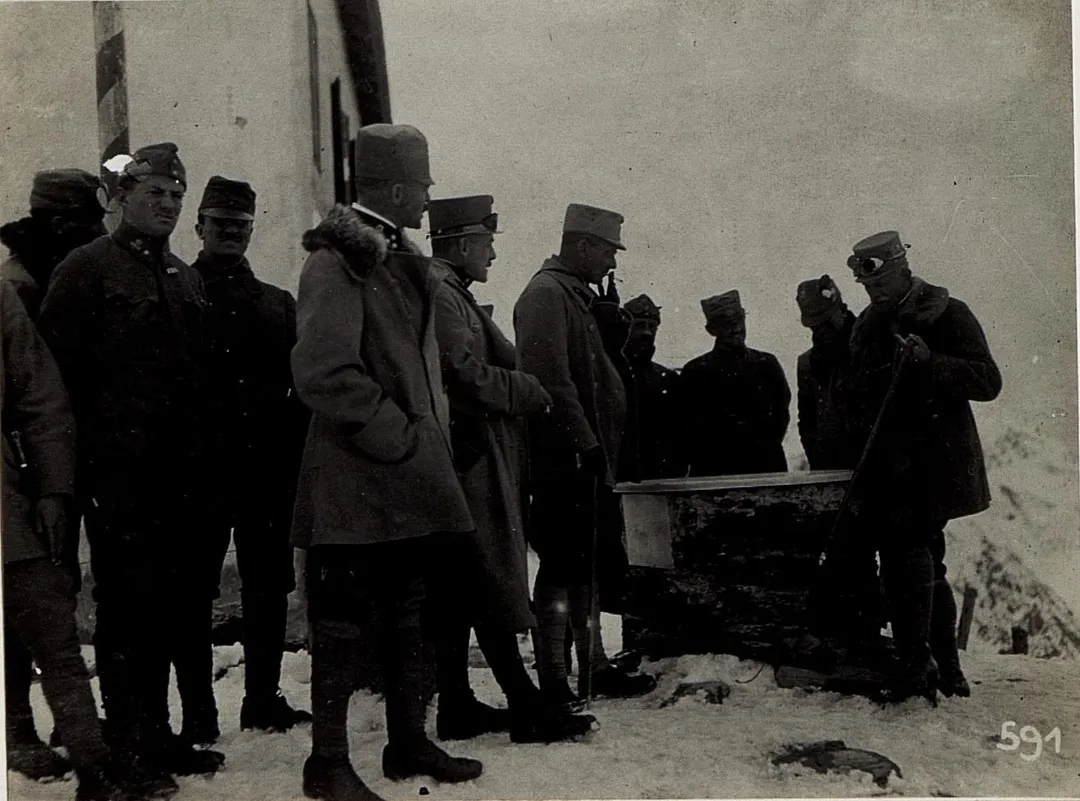
The Austrian army’s own press photographers recorded what happened to the pass. Their pictures show the Hotel Ferdinandshöhe and an Italian Carabinieri barracks, both shot to pieces. Neutral Switzerland shaped the fighting too. According to the Swiss association, Italian guns could have reached the Austrian positions on the pass and down to Trafoi, but firing there would have violated Swiss neutrality, and after objections it was done only very rarely. The Stelvio National Park has run guided walks to the wartime positions.
Coppi, and a television show
On 1 June 1953 the Giro d’Italia climbed the Stelvio for the first time, on the second-to-last stage, from Bolzano to Bormio. Fausto Coppi started the day 1 minute 59 seconds behind the race leader, the Swiss rider Hugo Koblet. According to the Giro’s own history, Coppi crossed the summit alone — 2 minutes 48 seconds ahead of Gino Bartali and 4 minutes 25 seconds ahead of Koblet — won the stage, and won his fifth Giro. The Giro’s own history calls the Stelvio its most iconic Cima Coppi, the name it gives to the highest point of each edition.
In 2008 Top Gear declared the Stelvio “the greatest driving road on the planet”. Its 2025 anniversary piece takes that back: “it isn’t and never has been”.
Up and over
The pass stands at 2,757 metres — the figure used by the Giro and by ANAS, the Italian road agency; 2,758 metres also circulates. The original project measured the road from Bormio to the top at 20.4 kilometres, according to Strade & Autostrade. On the Bormio side, a branch of only 0.2 kilometres leads off to the Umbrail Pass at 2,503 metres and down into Switzerland; ANAS opens and closes it together with the Swiss authorities.
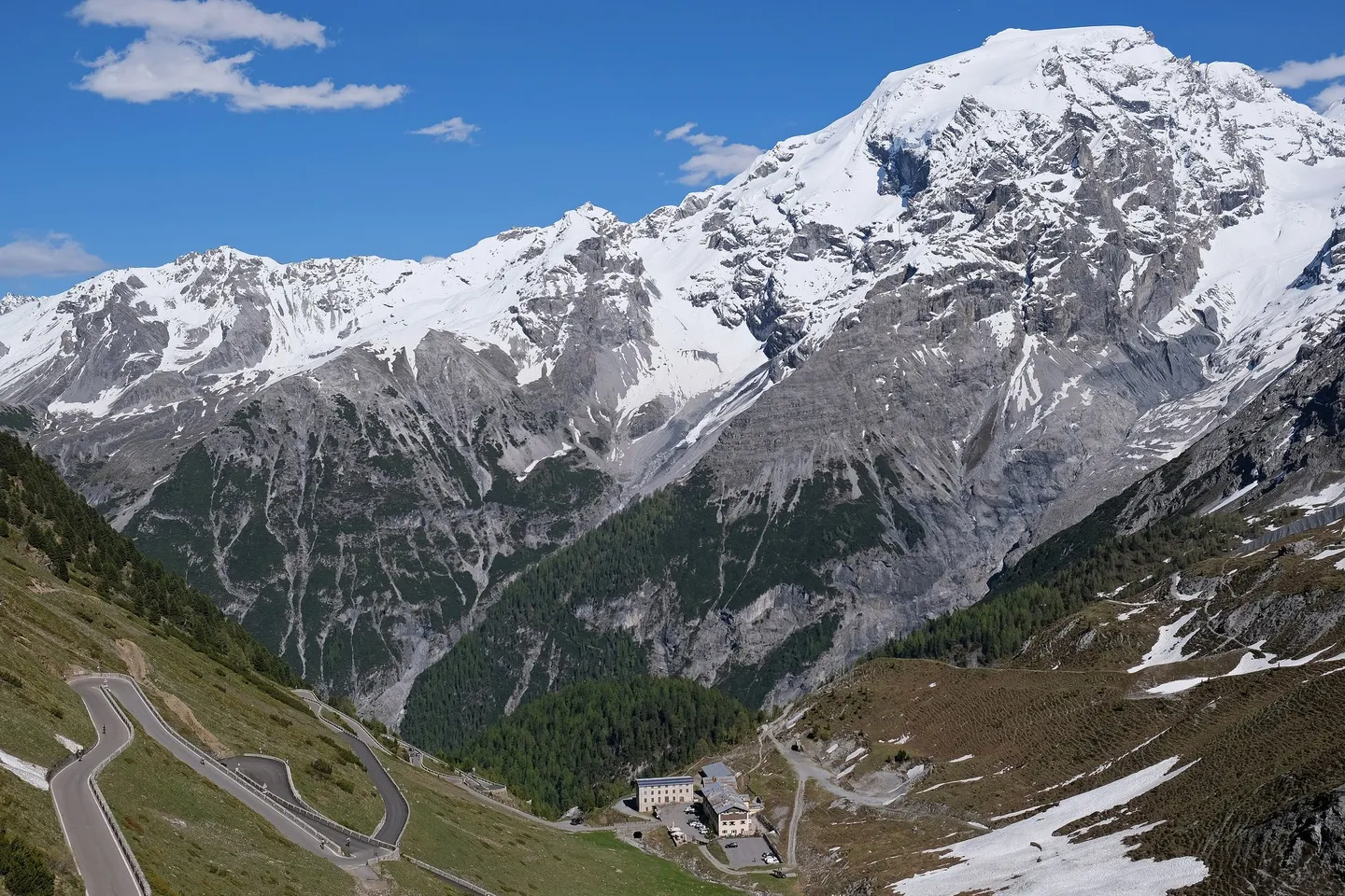
In 2025 the road turned two hundred. Lombardy, South Tyrol and the Swiss Val Müstair celebrated together, and the main events were planned for 5 and 6 July — two hundred years after the date Il Giorno gives for the inauguration.
Before you go
Season. The pass is closed in winter and opens when the snow has been cleared. In 2026 ANAS announced the reopening of the Lombard side and the Umbrail for 10:00 on 22 May, together with the South Tyrolean side. In 2024 the province of Bolzano expected to open its side only on the weekend of 22–23 June, because clearing had been harder than usual. Closing depends on the weather. In 2024 the Lombard side and the Umbrail closed on 4 November; the province of Bolzano kept its side open until the afternoon of 18 November, which it said was longer than usual thanks to an exceptionally warm year. Check the live status before you drive.
Cyclists’ day. On Stelvio Bike Day the road from Trafoi to the summit is closed to motor vehicles from 08:00 to 16:00; the climbs from Bormio and from Santa Maria over the Umbrail are part of the day too. In 2026, the national park counted 18,600 cyclists. The next edition is on 28 August 2027.
Skiing in summer. Above the pass there is a summer ski area; its operator planned the 2026 season for 30 May to 1 November.
Drive it yourself
The day-by-day route, real costs and where to sleep are in the itinerary. The planner draws it on the map from wherever you start.
Sources
- Strade & Autostrade — La strada dello Stelvio 1820–1825 (Cristina Pedrana Proh)
- Politecnico di Milano — Carlo Donegani Engineer. The Stelvio road 1820–1825
- Il Giorno — Duecento anni della strada dello Stelvio
- Top Gear — Happy birthday Stelvio (2025)
- Valtellina Mobile — Quando 2500 uomini costruirono l'impossibile
- Stelvio-Umbrail 14/18 — Scorluzzo
- Storia e Memoria di Bologna — La guerra sulle Alpi 1915
- Giro d'Italia — Stelvio
- Gazzetta delle Valli — Riaprono il passo dello Stelvio e il passo Umbrail (2026)
- Gazzetta delle Valli — Chiude il passo dello Stelvio (2024)
- Provincia di Bolzano — Stilfser-Joch-Straße öffnet voraussichtlich am Wochenende (2024)
- Provincia di Bolzano — Chiusura invernale per i passi Stelvio, Rombo e Stalle (2024)
- Stelvio National Park — Stelvio Bike Day
- Passo dello Stelvio summer ski area
Every fact in this story comes from the sources above. Where they disagree, the text says so. Found a mistake? Write to hello@roadcutco.com.