The Delta Works: the road along the top of the answer
In one night in 1953 the North Sea killed 1,836 people in the Netherlands. The country's answer was to shut the sea out of Zeeland — and then, after a fight over oysters, tides and money, to leave one door open.
On the evening of Saturday 31 January 1953 a heavy north-westerly storm was blowing over Zeeland. At around half past ten that night the tide should have been low. It was not. It was a spring tide, the wind had piled up the water of the North Sea, and the level was still at high-water mark. At around half past three in the morning, according to Zeeuwse Ankers, the heritage site of the Zeeland library, the water reached 455 centimetres above NAP, the Dutch reference level — some three metres above a normal high tide.
By the end of Sunday, 1,836 people in the Netherlands had drowned. The roads that now run south-west from Rotterdam across Zeeland run along the top of what the country built so that it would not happen again.
The night of 31 January
The dikes gave way across the islands. In Zeeland alone, Zeeuwse Ankers counts 125 polders flooded, almost 40,000 hectares, 38 kilometres of damaged dike and 3.5 kilometres of breaches through which the tide now flowed in and out. Nationally, the Canon of the Netherlands puts the flooded area at 200,000 hectares.
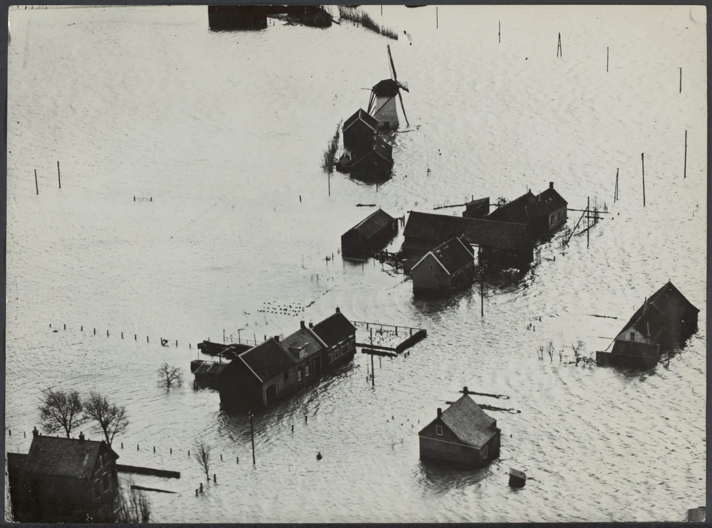
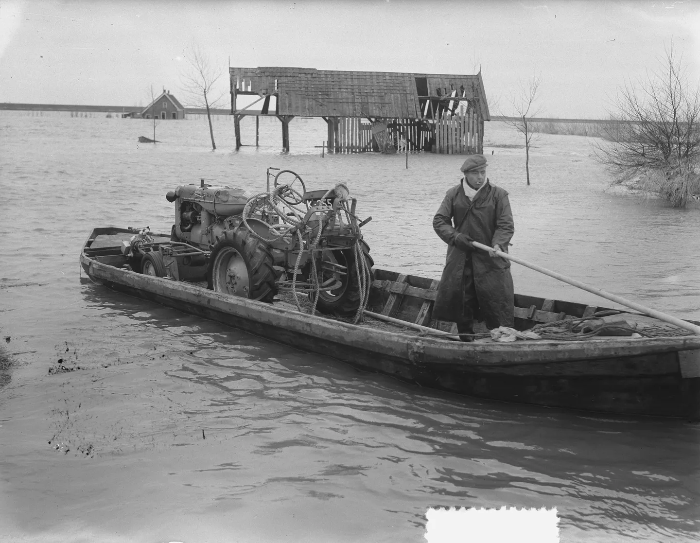
The water barely fell on Sunday. The second high tide, in the afternoon, came in even higher than the first. On Schouwen-Duiveland, where 534 people died, many of them drowned in that second flood. On Duiveland alone, Zeeuwse Ankers lists 289 dead in Nieuwerkerk, 91 in Ouwerkerk and 65 in Oosterland.
The figure on which the Watersnoodmuseum and the Canon of the Netherlands agree is 1,836 dead, along with tens of thousands of animals. Zeeuwse Ankers gives “about 1,835”, of whom 873 in Zeeland, 686 in South Holland and 254 in North Brabant. About 72,000 people had to leave their homes for a long time, according to the museum. Belgium, Britain, the United States, Canada, France and Sweden sent soldiers and equipment.
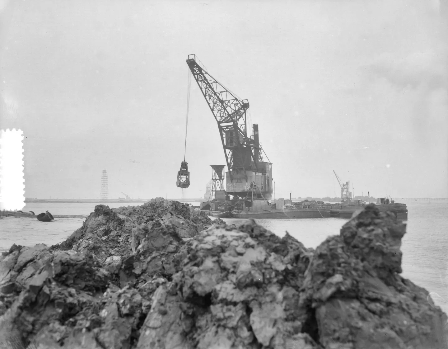
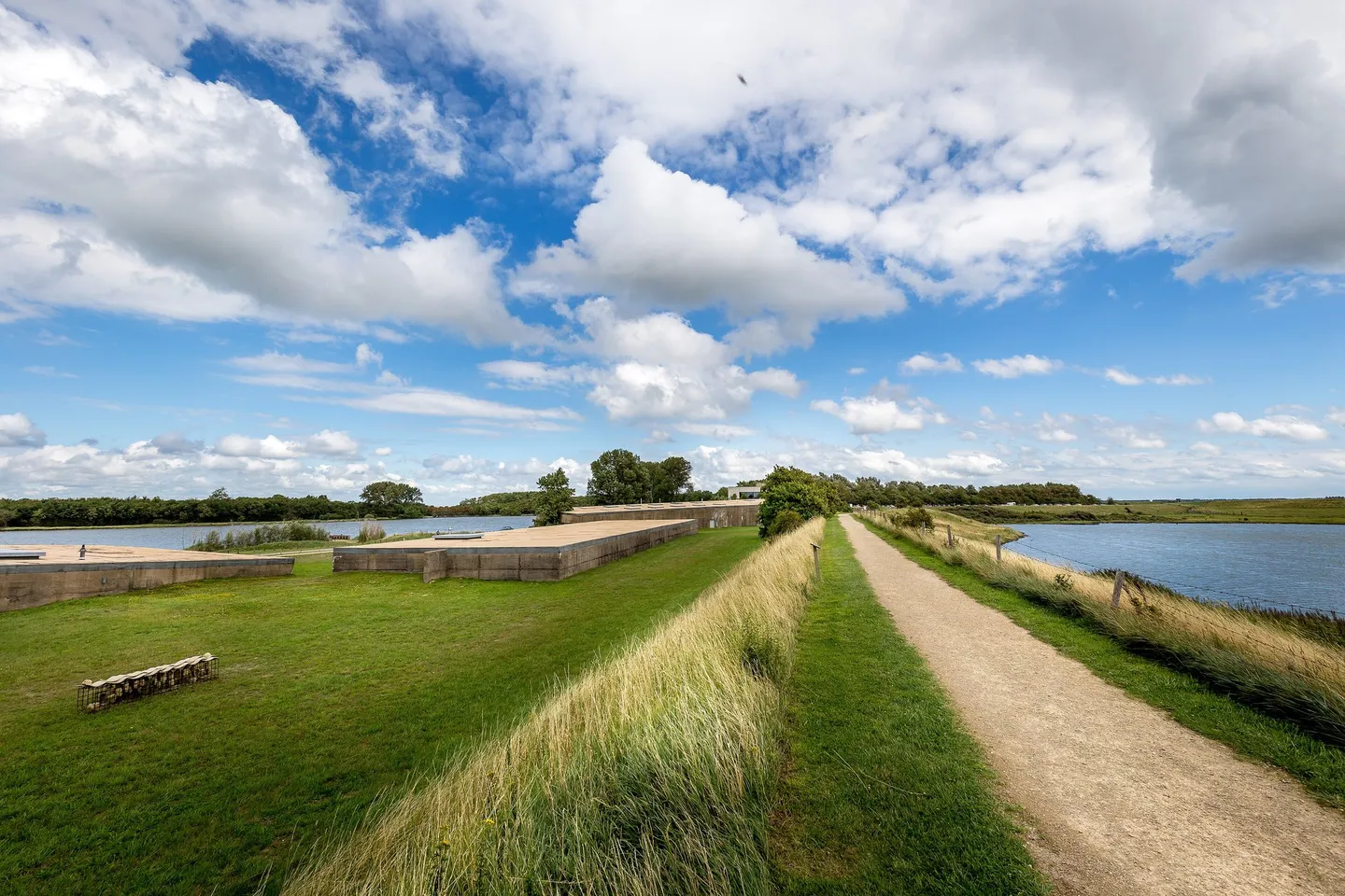
Closing the breaches took most of the year. The last and largest was at Ouwerkerk. In the night of 6 to 7 November 1953 it was closed with four caissons, huge concrete boxes sunk into the gap. They are still there, and they house the Watersnoodmuseum.
Close the sea
The plan for an answer was older than the disaster. The Canon of the Netherlands records that the hydraulic engineer Johan van Veen submitted his plan for the delta to the Ministry of Public Works towards the end of January 1953 — a few days before the flood.
Within three weeks of the flood, on 21 February 1953, the government set up a Delta Committee under A.G. Maris, the director-general of Rijkswaterstaat. Its first advice came on 26 May 1953, its last on 18 October 1955. On 8 May 1958 Queen Juliana signed the Delta Act. The idea was simple and enormous: close the sea arms of the south-west, except the Westerschelde and the Nieuwe Waterweg — in the words of Andere Tijden, the economic arteries — and strengthen the dikes behind them.
Rijkswaterstaat today counts the Delta Works as five storm surge barriers, two sluice complexes and six dams, built over 43 years, from 1954 to 1997.
Over the dams
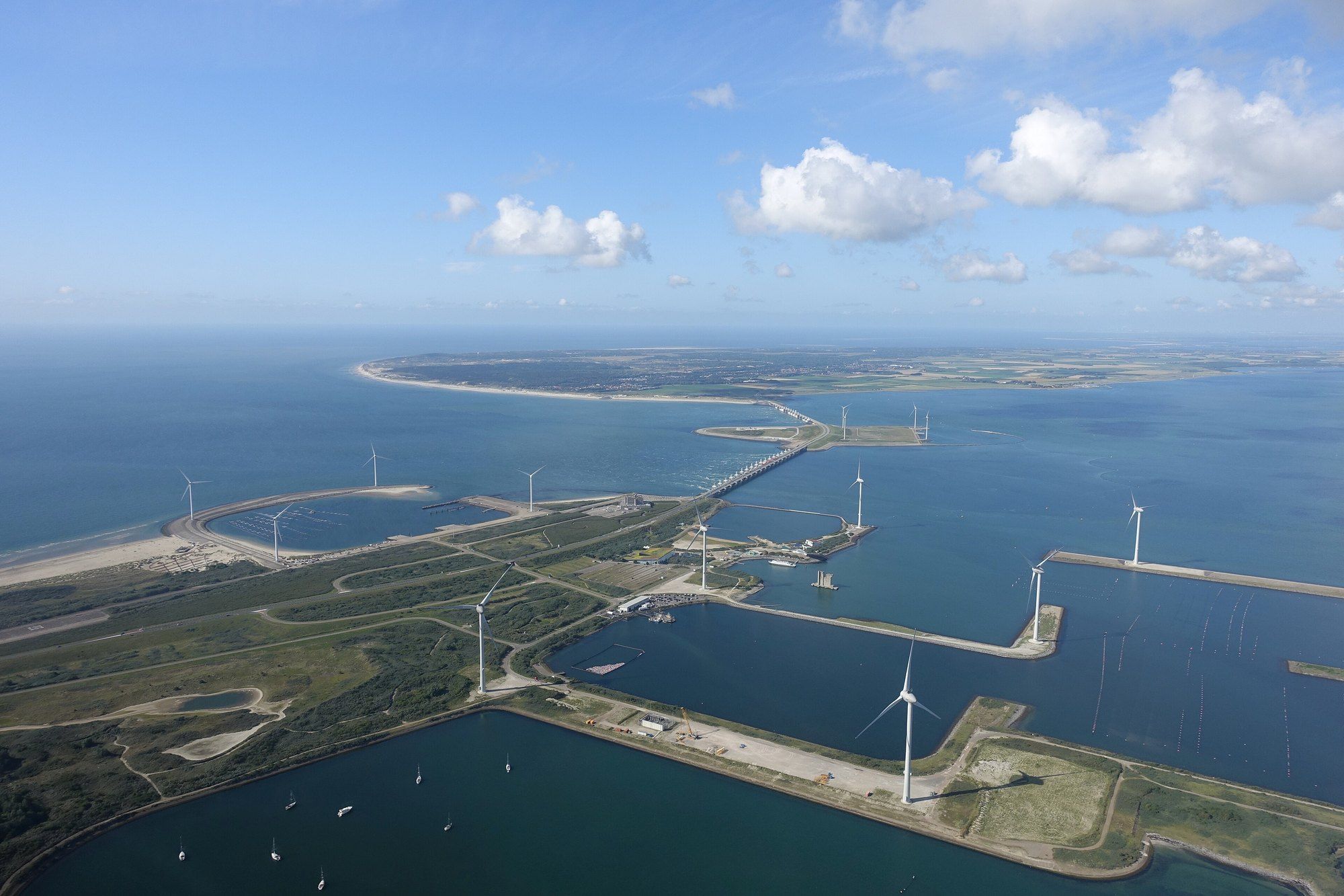
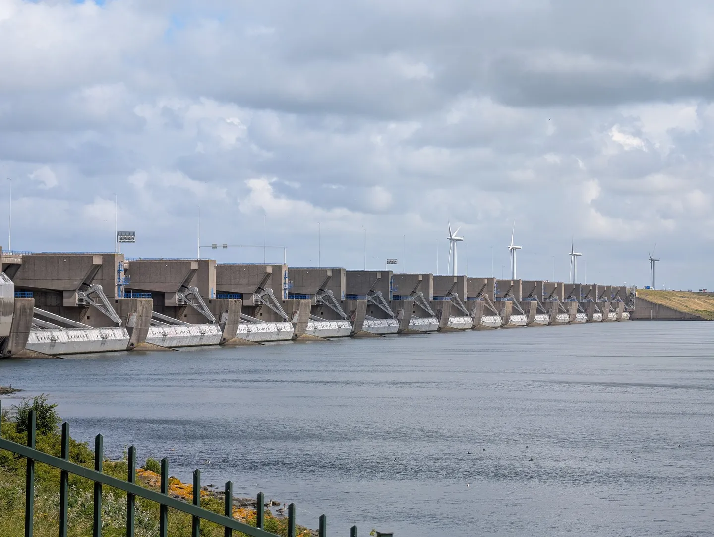
South of Rotterdam the road meets the first of them. The Haringvliet sluices, built between 1956 and 1970, close the Haringvliet between Voorne-Putten and Goeree-Overflakkee. They are a kilometre long, with 17 openings each 56.5 metres wide and 34 gates, and according to Rijkswaterstaat they discharge up to 70 per cent of the Rhine and Meuse water that reaches them — some 30 billion cubic metres a year. Since 2018 the gates have been set ajar on the incoming tide so that salmon, eel and sea trout can swim upriver again.
Next is the Brouwersdam, between Goeree and Schouwen-Duiveland, and the N57 runs across it. Rijkswaterstaat gives its length as 6.5 kilometres and its construction as 1962 to 1971; the Zeeuws Archief, the provincial archive, dates the work from 1963 and the opening of the road on the dam to 30 June 1972. On one side is the North Sea; on the other is the Grevelingenmeer, which Rijkswaterstaat calls the largest saltwater lake in Western Europe, at 11,000 hectares. The closed lake turned out to need the sea after all: in 1978 the Brouwerssluis was opened to let salt water back in.
The fight over the Oosterschelde
Under the Delta Plan the Oosterschelde was to be closed too, with a fixed dam. Work began. According to Zeeuwse Ankers, sandbanks in its mouth were raised into islands — Roggenplaat in 1969, Neeltje Jans in 1970, Noordland in 1971.
But a closed Oosterschelde would no longer have tides, and without the tides its oysters, mussels and fishermen had no future. The Studiegroep Oosterschelde was formed in January 1968, bringing together fishing organisations, oyster growers, environmentalists and lawyers, and an Actiegroep Oosterschelde Open followed in Yerseke. Andere Tijden, the history programme of Dutch public television, records that the cabinet of Joop den Uyl, which took office in 1973, ordered a study of an alternative.
Work stopped. In 1974, according to Zeeuwse Ankers, the Tweede Kamer, the lower house of parliament, rejected by 75 votes to 67 a motion by the Anti-Revolutionary MP M. Schakel to close the Oosterschelde with a fixed dam. In 1976 the decision was final: the remaining four kilometres would get gates that closed only in extreme conditions. The Oosterschelde stayed salt and kept its tide.
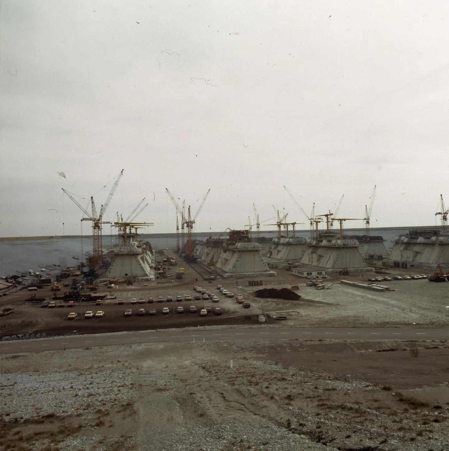
It was a much harder thing to build. The barrier stands on 65 prefabricated concrete piers. Each took a year and a half to build, and a new one was started every two weeks, on Neeltje Jans, which became a work island of more than 200 hectares with its own power station and concrete factory. Andere Tijden puts the final cost at 7.8 billion guilders — six times the price of the closed dam.
Nine kilometres of gates
On 4 October 1986 Queen Beatrix opened the barrier. Zeeuwse Ankers records her words: “The storm surge barrier is closed. The Delta Works are complete.” They were not, quite: the Maeslantkering, the barrier on the Nieuwe Waterweg near Hoek van Holland, followed in 1997, and Rijkswaterstaat counts it as the last of the Delta Works.
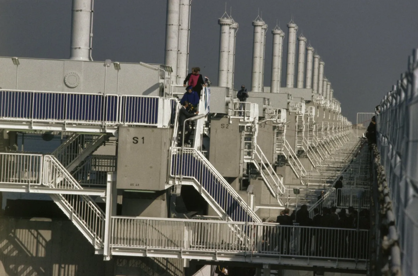
Rijkswaterstaat gives the length of the Oosterscheldekering as nine kilometres. Between its piers hang 62 steel gates, each 42 metres wide and between six and twelve metres high. They are almost always open. When the water is expected to reach three metres above NAP, the barrier is closed — all 62 gates at the push of a button, operated from the control centre in the Topshuis on Neeltje Jans. Closing takes about 75 minutes.
On average, Rijkswaterstaat says, the barrier closes once a year because of high water. When it turned 35 in October 2021, Omroep Zeeland counted 28 closures since 1986, and reported that it will have to close more often as the sea rises. The machinery is now old: Rijkswaterstaat is renovating the hydraulic cylinders and the beams that move the gates, which have been in use for more than 35 years.
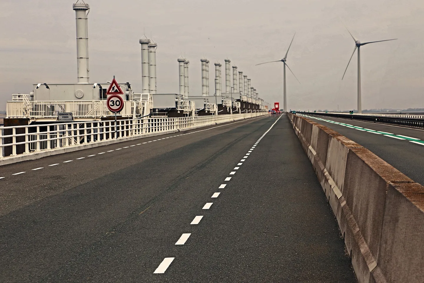
The N57 runs along the top of the barrier, with a cycle and footpath beside it. Neeltje Jans, the old work island, is now part of the Oosterschelde National Park, with viewpoints over the barrier. Further on, the route crosses the Oosterschelde again on the Zeelandbrug: just over 5,022 metres long, opened by Queen Juliana on 15 December 1965 — she paid a rijksdaalder toll at the booth — and until 1972 the longest bridge in Europe.
At Veere, where the itinerary’s second day ends, the Delta Works are older still. The Veerse Gatdam, 2.8 kilometres between Noord-Beveland and Walcheren, was closed on 27 April 1961, when seven caissons were sunk into the last gap, and the road over it opened that October. Behind it, what had been a sea arm became the Veerse Meer, a lake for sailing and holidays.
Before you go
The museum. The Watersnoodmuseum is in the four caissons at Ouwerkerk, on Schouwen-Duiveland, a short drive from Zierikzee, where the itinerary’s first day ends.
The barrier. According to Rijkswaterstaat the Oosterscheldekering is freely accessible, and the national park on Neeltje Jans has viewpoints over it. Deltapark Neeltje Jans, a theme park on the old work island, offers visits to the barrier itself.
Short closures. During the renovation, Rijkswaterstaat closes the N57 between De Banjaard and Westenschouwen for about half an hour at a time while the machinery is lifted in or out — in August 2026, for example, on four days between 09:00 and 15:00. Traffic is diverted via the Zeelandbrug (N256), which can add about 30 minutes. Rijkswaterstaat announces the closures in advance; check zeelandbereikbaar.nl before you cross.
Works season. Rijkswaterstaat carries out maintenance on the barrier from April to September, outside the storm season.
Drive it yourself
The day-by-day route, real costs and where to sleep are in the itinerary. The planner draws it on the map from wherever you start.
Sources
- Watersnoodmuseum — Watersnoodramp van 1953
- Watersnoodmuseum — The Museum
- Watersnoodmuseum — About us
- Zeeuwse Ankers — Watersnoodramp van 1953
- Zeeuwse Ankers — Watersnoodramp 1953: slachtoffers en hulp
- Canon van Nederland — The great flood
- Geschiedenis van Zuid-Holland — De aanleg van de Deltawerken
- Zeeuws Archief — De Deltawerken afzonderlijk
- Rijkswaterstaat — De Deltawerken
- Rijkswaterstaat — Haringvlietsluizen
- Rijkswaterstaat — Brouwersdam
- Rijkswaterstaat — Oosterscheldekering
- Rijkswaterstaat — Oosterscheldekering: renovatie bewegingswerken
- Rijkswaterstaat — N57: Oosterscheldekering dicht op 11, 13, 17 en 19 augustus 2026
- Zeeuwse Ankers — Protestbewegingen tegen afsluiting van de Oosterschelde
- Zeeuwse Ankers — Stormvloedkering in de Oosterschelde
- Zeeuwse Ankers — Oosterscheldekering
- Andere Tijden — Beter ten halve gekeerd
- Omroep Zeeland — Jarige stormvloedkering in de toekomst steeds vaker dicht (2021)
- Deltapark Neeltje Jans — Stormvloedkering
- Zeeuwse Ankers — Zeelandbrug
Every fact in this story comes from the sources above. Where they disagree, the text says so. Found a mistake? Write to hello@roadcutco.com.