Lake Garda Circuit: 210 km Around Italy's Largest Lake in 3 Days
A 210 km loop around Lake Garda from Verona in three days — Sirmione, the cliff tunnels of the western shore, the Strada della Forra and Monte Baldo.
Rough estimate — fuel + nights at typical rates. Get an exact figure in the calculator.
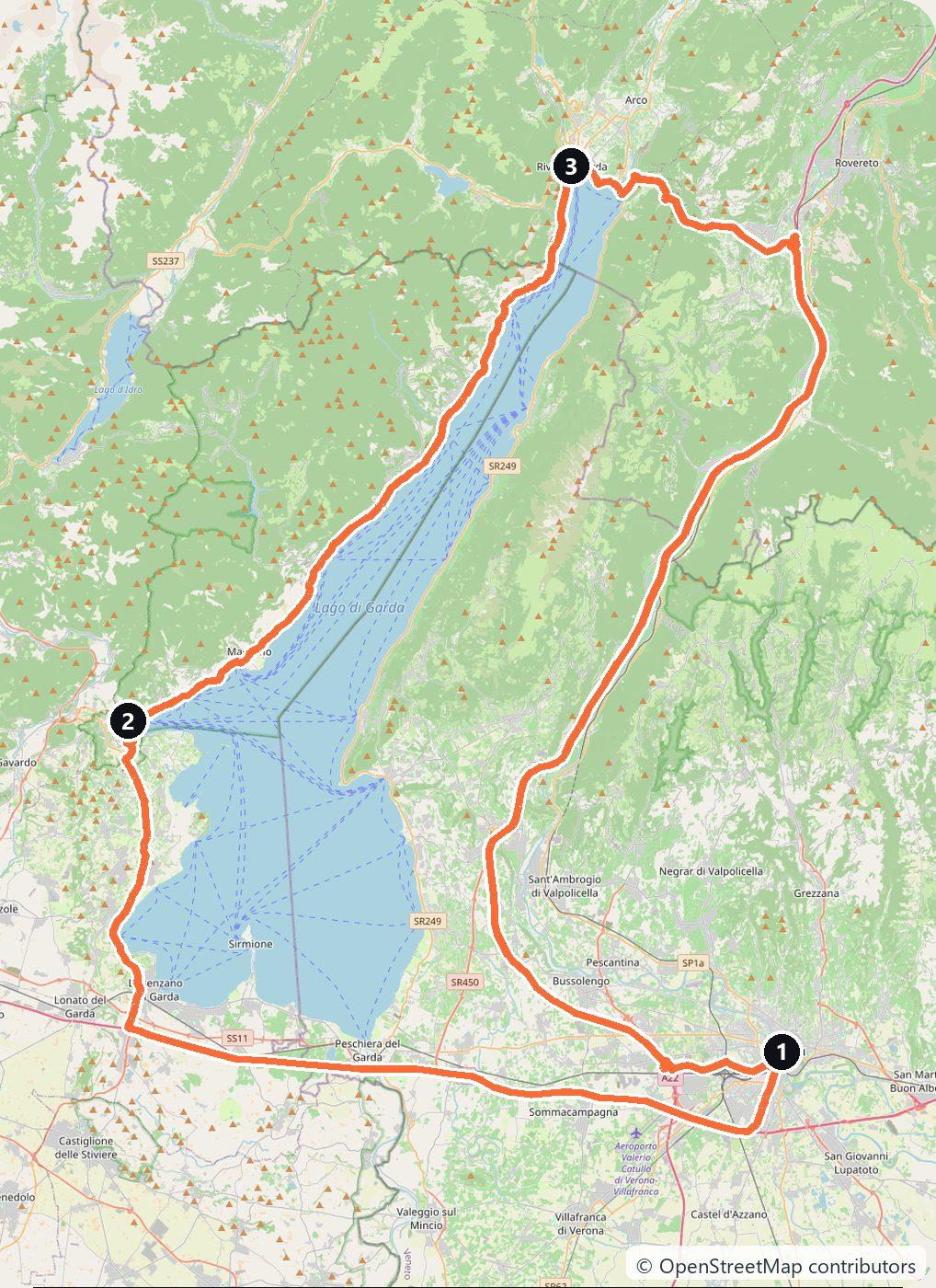
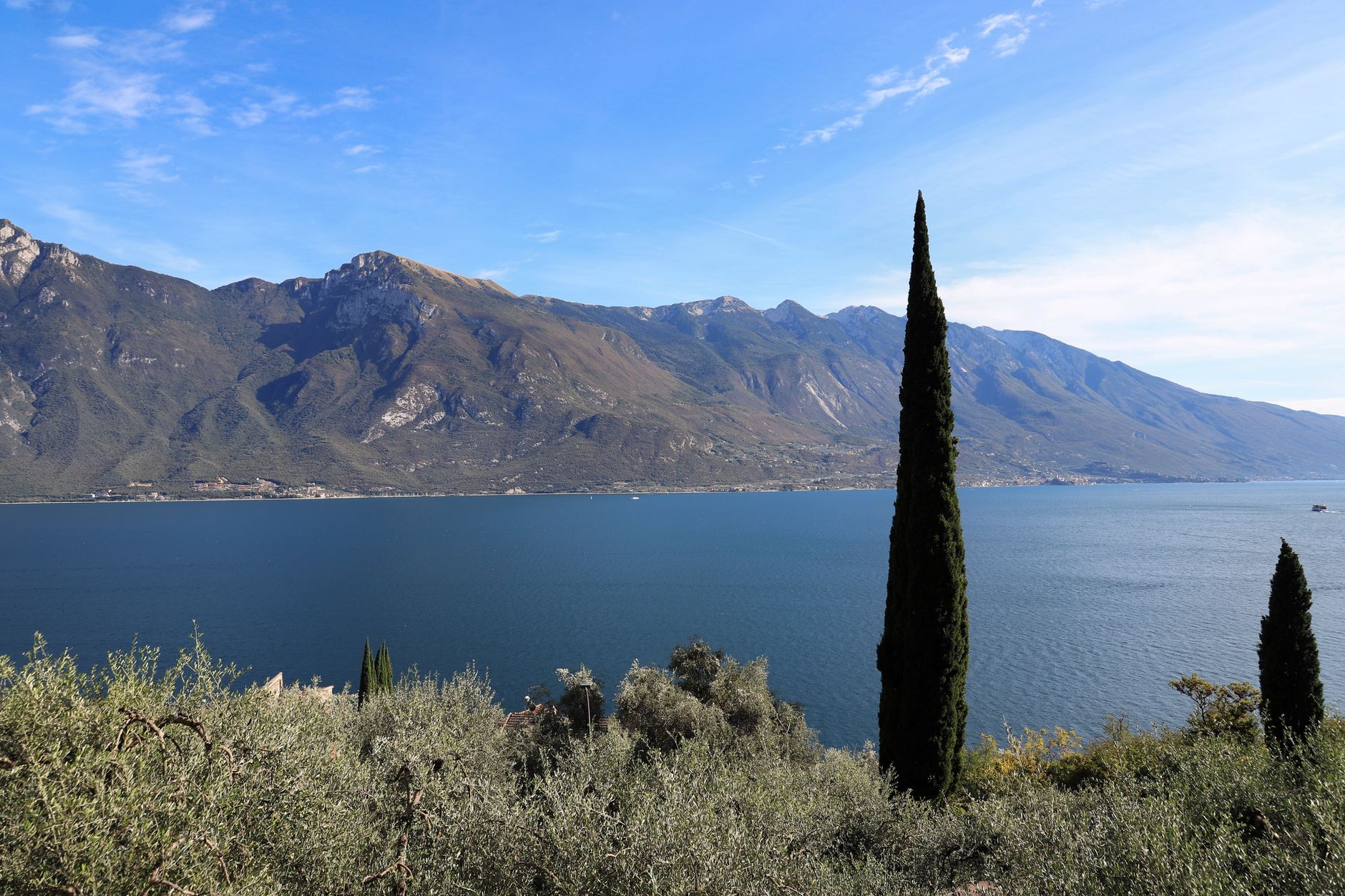
Lake Garda is Italy’s largest lake, and three regions share its shore: Lombardy on the west, the Veneto on the east and Trentino at the narrow northern tip, where the mountains close in. A road runs all the way round — the Gardesana — and over three days a loop from Verona covers about 210 km, with one detour up the most famous few kilometres of road on the lake.
The two shores drive very differently. The western side, the Gardesana Occidentale (SS45bis), is cut into the cliffs: narrow, tunnelled, slow and spectacular. The eastern side, the Gardesana Orientale (SS249), is wider and easier, with the bulk of Monte Baldo above it. In July and August both are busy from mid-morning, so the rule for this whole route is simple: drive early, stop often, and do not plan on making good time.
Day 1 — Verona to Sirmione and Salò (65 km)
Pick up the car at Verona and take the A4 west to the Sirmione exit. Sirmione sits on a thin peninsula pushing into the southern end of the lake, and the old town at its tip is a limited traffic zone: day visitors cannot drive past the Scaliger castle, and cameras fine cars that try. Park at the car parks at the start of the peninsula and walk in. The castle, with its own walled harbour, guards the gate; at the far end are the Grotte di Catullo, the ruins of a large Roman villa above the water.
From Sirmione follow the southern shore west and then north to Salò, with a long lakeside promenade, and on to Gardone Riviera. Here is the strangest house on the lake: the Vittoriale degli Italiani, the estate the poet Gabriele D’Annunzio built for himself, with the bow of a warship set into the hillside among the gardens. Sleep in Salò or Gardone.
Day 2 — The western shore and the Strada della Forra (65 km)
North of Gargnano the SS45bis runs through tunnel after tunnel cut into the rock, with the lake flashing through the openings. This is the drive people come for, and the reason to do it in the morning, before the traffic builds up behind every slow vehicle in the tunnels.
At the bottom of the Brasa gorge, turn up the Strada della Forra (SP38) to Tremosine. It is only about 5.8 km, but it squeezes through a canyon so narrow that the light barely reaches the road, in tunnels and on ledges carved out of the walls. Two things to know before you turn off. Since the road reopened after a landslide, the lower section through the gorge has been one-way uphill, so you can only drive it from the lake up, never down — which is why this route takes it northbound. And it is closed to motorhomes and trailers, and to vehicles wider than 2.20 m or taller than 3.00 m.
At the top, the village of Pieve stands on the very edge of the cliff above the lake. Continue through the plateau villages to Vesio and take the road back down to Limone sul Garda, where the terraced lemon houses — the stone pillars that once carried winter roofs over citrus trees — still climb the slope behind the harbour. The Limonaia del Castèl is restored and open to visit. Then follow the shore to Riva del Garda, at the northern tip, and stay the night.
Day 3 — Riva, Malcesine and the eastern shore back to Verona (80 km)
Before you leave Riva, the Cascata del Varone waterfall drops through a narrow gorge a short drive inland. The old Ponale road that climbs out of Riva above the lake is closed to cars and is now a walking and cycling path — worth an hour on foot if you have it.
Round the head of the lake to Torbole, where the reliable afternoon wind has made the water one of Europe’s best-known windsurfing spots, then turn south on the SS249 to Malcesine and its Scaliger castle, the castle Goethe was caught sketching in 1786 and briefly taken for a spy. From Malcesine the Monte Baldo cable car climbs in two sections to about 1,780 m; the upper cabin turns a full circle on the way up, and the view at the top takes in the whole lake.
Drive on south past Garda and Bardolino, the home of the light red wine of the same name, and back to Verona. If you would rather cut the loop short, a year-round car ferry links Toscolano-Maderno on the west shore with Torri del Benaco on the east in about half an hour, with fewer crossings in winter.
Costs
Use the cost calculator to price fuel and nights for your dates. Budget for accommodation, fuel for about 210 km, car rental, the short A4 toll from Verona to Sirmione, parking in every town — almost all of it paid in summer — and tickets for the Vittoriale, the Grotte di Catullo, the Monte Baldo cable car and the car ferry if you use it. The lake is busiest from June to early September; in May, June and September the roads are far quieter and the hotels cheaper.
This trip is also in the free Roadcut trip planner: change the number of days and where you sleep each night, pick your vehicle to see the fuel cost, check the weather on the road, and open each day in Google Maps, Apple Maps or Waze.
Where to stay on this route
Night by night, in the towns this itinerary sleeps in.
The search opens with sample dates a month from today — change them to yours on Booking. Affiliate link — we may earn a commission at no extra cost to you.
The route on video
Get this itinerary by email
The days and the nights in your inbox, with a link back here when you are ready to book.
We use your address only to send this itinerary, unless you tick the box. Privacy
⚡ By electric car on this route
74 charging stations within 1.5 km of the road, 21 of them fast (DC). Most powerful: 400 kW.
Longest stretch without a fast charger tagged: 89 km, from km 26 of the route.
According to OpenStreetMap and operators’ websites. Fast = a DC plug or 50 kW and more; not every station has its power filled in, so there may be more. See them on the planner map → · EV charging →
🚦 Know before you go
Vignette · Tolls · Ferries · Good to know
Vignette. Italy has no vignette. Drivers coming from Germany over the Brenner need the Austrian vignette plus the separate Brenner motorway toll, and anyone crossing Switzerland needs the Swiss vignette.
Tolls. Italian motorways charge by distance, paid at the booth on exit. The only motorway on this loop is the short A4 stretch from Verona to the Sirmione exit; the Gardesana roads around the lake, the Strada della Forra and the road up to Tremosine are all free.
Ferries. No ferry is needed for the loop. A car ferry links Toscolano-Maderno on the west shore with Torri del Benaco on the east in about 30 minutes. It runs all year, with fewer crossings on the winter timetable from about November to March.
Good to know. The lower section of the Strada della Forra (SP38) through the gorge is permanently one-way uphill, so drive it from the Gardesana up to Tremosine, never down, and come back via the SP115 to Limone or via Tignale. It is closed to motorhomes and trailers and to vehicles over 2.20 m wide or 3.00 m high. Sirmione's old town is a camera-enforced limited traffic zone: park at the start of the peninsula and walk in.
Estimate your exact costs in the cost calculator. Prices are approximate — check official sites before you travel. Some links are affiliate links.
Plan this trip
Where to sleep
Hotels & B&Bs →Holiday homes & apartments →Campsites (bookable) →Campervan & overnight spots →Tours & tickets
Find things to do →Affiliate link — we may earn a commission at no extra cost to you.
Drive on from here
More roads nearby
- Franconia Christmas Markets Road Trip: 344 km from Nuremberg in 4 Days344 km · 4 days
- Lake Constance Road Trip from Friedrichshafen: Three Countries, the Rhine Falls and Lindau in 3 Days270 km · 3 days
- Langhe and Barolo Road Trip from Turin: Alba, Barbaresco and the Wine Castles in 3 Days253 km · 3 days
New road trips in your inbox
One email when we publish a new European route — the full guide, map and real costs. No spam, unsubscribe anytime.