Småland and Öland from Malmö: Glass, Castles and Lighthouses in 5 Days
A 945 km loop through southern Sweden from Malmö in five days — the glassworks of Småland, Kalmar Castle, both ends of the island of Öland and the naval town of Karlskrona.
Rough estimate — fuel + nights at typical rates. Get an exact figure in the calculator.
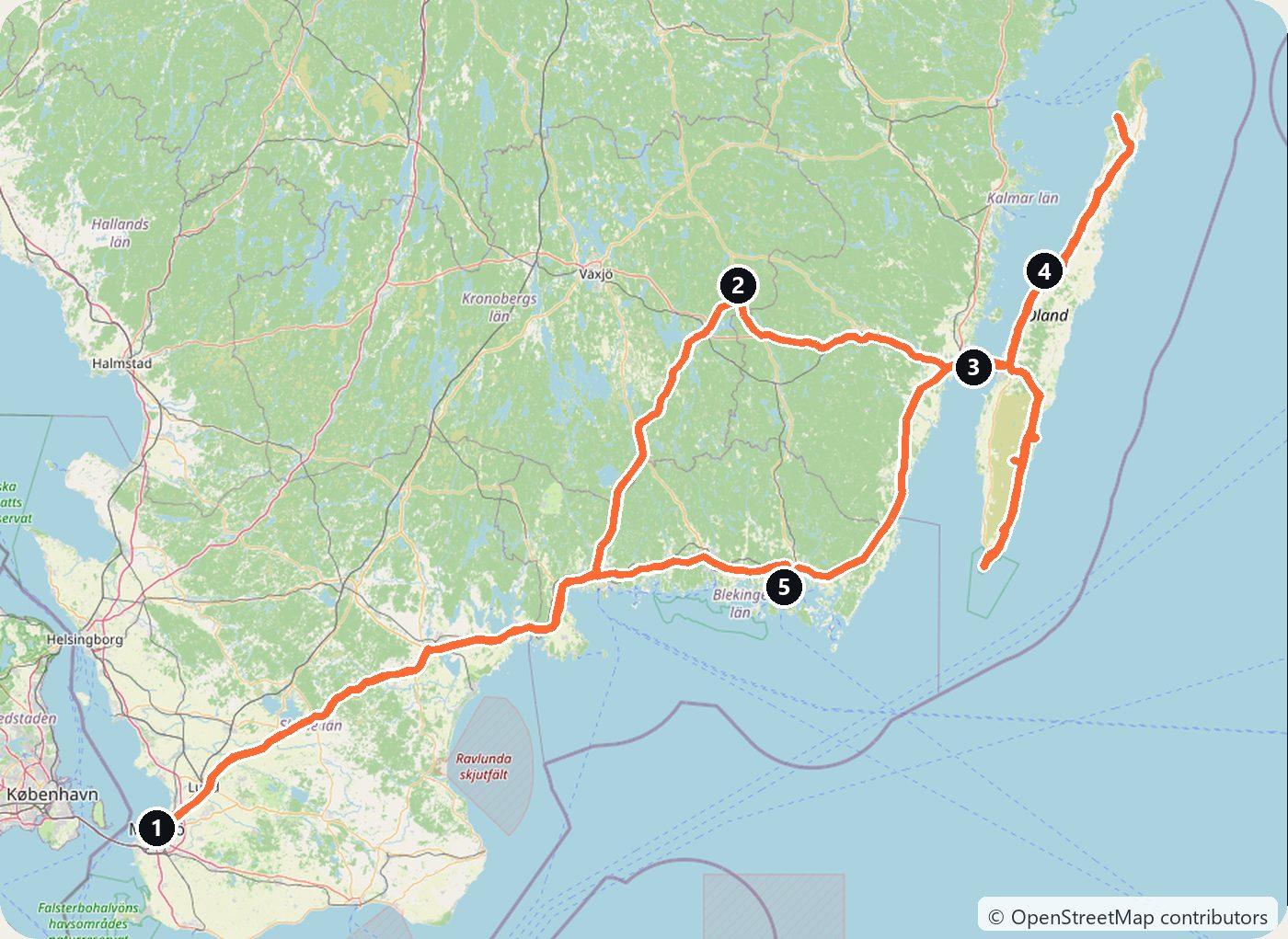
Southern Sweden is the Sweden most drivers picture: forest and lakes, red wooden houses, empty roads. This loop starts in Malmö, crosses the forests of Småland to the old glassworks, follows the coast to Kalmar and then spends two days on Öland, a long, flat limestone island with a lighthouse at each end. It comes home through Karlskrona, the navy’s town, and makes about 945 km in five days.
Sweden is easy to drive. There is no motorway toll and no vignette; the only charges are congestion taxes in Stockholm and Gothenburg and three bridge charges in Motala, Sundsvall and on the Skurubron, and this route touches none of them. You drive on the right, and the law wants your lights on at all times, day and night. In the forests of Småland, watch for elk and deer at dawn and dusk.
Day 1 — Malmö to Kosta (235 km)
Pick up the car in Malmö and drive north-east out of Skåne’s farmland into the forests of Småland. The day ends in Kosta, the heart of the Glasriket, the Kingdom of Crystal: a cluster of glassworks scattered through the woods between Växjö and Kalmar.
Kosta is the oldest of them. Two officers of Charles XII founded it in 1742 and named it after themselves, Koskull and Staël von Holstein, and its furnaces have burned ever since. In the hot shop you can watch the glassblowers at work, and the village around it is built for visitors, with shops, a gallery and a hotel. Stay the night.
Day 2 — Orrefors to Kalmar (75 km)
A short drive east brings you to Orrefors, founded in 1898 on the site of an old ironworks. It became famous in the 1920s for thin engraved art glass, but glassmaking in the village itself has ended; what remains is a museum and shop, and it is worth checking their hours before you go.
Continue to Kalmar on the coast. Kalmar Castle began as a round tower in the twelfth century and was rebuilt by the Vasa kings in the sixteenth into a Renaissance palace, one of the best preserved in the Nordic countries. In 1397 it was the stage for the Kalmar Union, which put Denmark, Norway and Sweden under one crown. The old town on Kvarnholmen, with its cathedral and square, is compact enough to walk. Sleep in Kalmar.
Day 3 — Northern Öland (180 km)
Cross the Öland Bridge: at 6,072 m it was the longest bridge in Europe when it opened in 1972, and it costs nothing to drive. Head north to Borgholm, the island’s small capital. Above the town stands the shell of Borgholm Castle, a fortress turned palace that burned in 1806 and has been a ruin ever since; a museum now fills part of it. Just south lies Solliden, the Swedish royal family’s summer villa, built for Queen Victoria from 1903; its park and gardens open to visitors in summer.
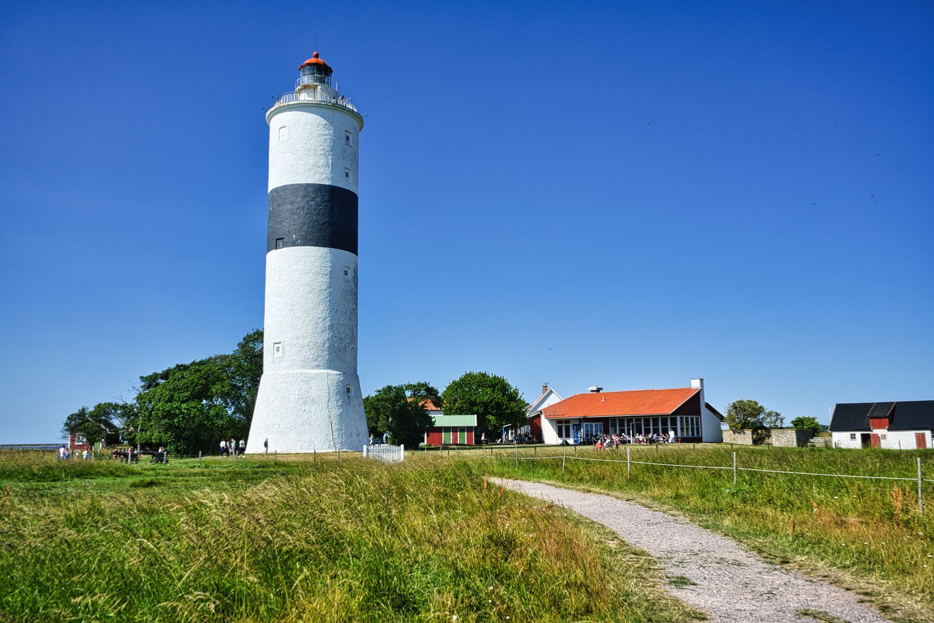
Then drive up the island’s west coast to Byrums raukar, a nature reserve where the sea has cut about 120 limestone pillars, full of fossils, along the beach. At the northern tip, Långe Erik, a lighthouse lit in 1845, stands on a little island reached by a bridge. Drive back down to Borgholm for the night.
Day 4 — Southern Öland to Karlskrona (250 km)
The south of the island is the Stora Alvaret, a wide, treeless limestone plain, and the farmland around it is a UNESCO World Heritage Site, the Agricultural Landscape of Southern Öland, listed in 2000. People have farmed here for some five thousand years, and the villages, stone walls and windmills along the road show it.
Stop at Eketorps borg, a round Iron Age fort that was fully excavated and then rebuilt as a museum; opening hours are seasonal, so check before you go. At the southern tip stands Långe Jan, at 41.6 m the tallest lighthouse in Sweden, lit in 1785, with the Ottenby bird station beside it. Then cross back over the bridge and drive south along the coast to Karlskrona for the night.
Day 5 — Karlskrona to Malmö (205 km)
Karlskrona was founded in 1680 as the base of the Swedish navy, and the whole planned town, with its docks, fortifications and churches, is a UNESCO World Heritage Site, the Naval Port of Karlskrona, listed in 1998. Walk the island of Trossö before you leave, then follow the coast west through Blekinge and Skåne back to Malmö.
Costs
Use the cost calculator to price fuel and nights for your dates. There are no tolls on this route, and the Öland Bridge is free. Budget for accommodation, fuel for about 945 km, car rental, and entry to Kalmar Castle, Borgholm Castle and Eketorps borg. Many of Öland’s sights and much of its accommodation open only in the summer season, so outside it check opening dates before you book. From 1 December to 31 March a car must have winter tyres whenever there is snow, ice or frost on the road, so check that a winter rental has them.
This trip is also in the free Roadcut trip planner: change the number of days and where you sleep each night, pick your vehicle to see the fuel cost, check the weather on the road, and open each day in Google Maps, Apple Maps or Waze.
Where to stay on this route
Night by night, in the towns this itinerary sleeps in.
- Night 1Hotels in Kosta →
- Night 2Hotels in Kalmar →
- Night 3Hotels in Borgholm →
- Night 4Hotels in Karlskrona →
The search opens with sample dates a month from today — change them to yours on Booking. Affiliate link — we may earn a commission at no extra cost to you.
The route on video
Get this itinerary by email
The days and the nights in your inbox, with a link back here when you are ready to book.
We use your address only to send this itinerary, unless you tick the box. Privacy
⚡ By electric car on this route
212 charging stations within 1.5 km of the road, 106 of them fast (DC). Most powerful: 400 kW.
Longest stretch without a fast charger tagged: 165 km, from km 433 of the route.
According to OpenStreetMap and operators’ websites. Fast = a DC plug or 50 kW and more; not every station has its power filled in, so there may be more. Power and stations missing from OpenStreetMap also from NOBIL by Enova (CC BY 4.0). See them on the planner map → · EV charging →
🚦 Know before you go
Vignette · Tolls · Bridges & tunnels · Good to know
Vignette. Sweden has no vignette and no motorway toll for cars. The only road charges are the congestion taxes in Stockholm and Gothenburg and the bridge charges in Motala, Sundsvall and on the Skurubron, and none of them is on this route.
Tolls. No tolls anywhere on this loop: the roads from Malmö through Småland, along the coast and on Öland are all free.
Bridges & tunnels. The Öland Bridge between Kalmar and the island is 6,072 m long and free to cross.
Good to know. Swedish law wants your lights on at all times, day and night. From 1 December to 31 March a car must have winter tyres whenever there is snow, ice or frost on the road. Many of Öland's sights, cafés and hotels open only in the summer season, so outside it check opening dates before you book.
Estimate your exact costs in the cost calculator. Prices are approximate — check official sites before you travel. Some links are affiliate links.
Plan this trip
Where to sleep
Hotels & B&Bs →Holiday homes & apartments →Campsites (bookable) →Campervan & overnight spots →Tours & tickets
Find things to do →Affiliate link — we may earn a commission at no extra cost to you.
Drive on from here
More roads nearby
- Bohuslän Coast Road Trip from Gothenburg: Marstrand, Smögen, Fjällbacka and the Tanum Rock Carvings in 3 Days522 km · 3 days
- Masurian Lakes Road Trip from Gdańsk: the Elbląg Canal, Wolf's Lair, Giżycko and Mikołajki in 4 Days685 km · 4 days
- Bornholm Road Trip from Copenhagen: Castle Ruins, Round Churches and Smokehouses in 3 Days306 km · 3 days
New road trips in your inbox
One email when we publish a new European route — the full guide, map and real costs. No spam, unsubscribe anytime.