Brittany Road Trip from Rennes: Pink Granite, Wild Capes and Carnac in 6 Days
An 820 km loop around the Brittany coast from Rennes in six days — Saint-Malo, Cap Fréhel, the Pink Granite Coast, the Crozon peninsula, Pointe du Raz and the standing stones of Carnac, with no motorway tolls.
Rough estimate — fuel + nights at typical rates. Get an exact figure in the calculator.
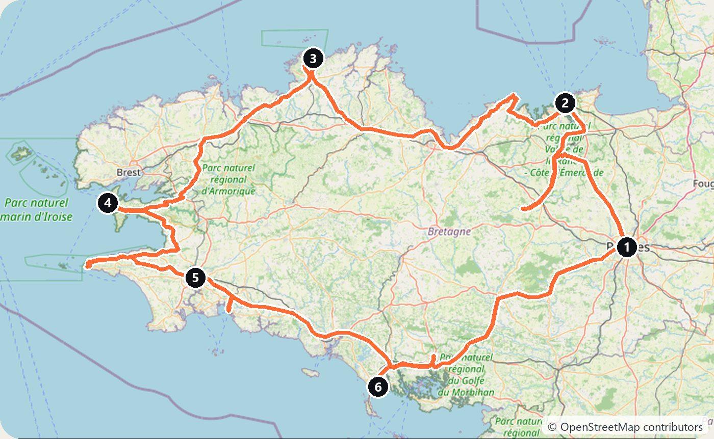
Brittany is the far western corner of France, a granite peninsula pushed out into the Atlantic. This loop starts in Rennes, the regional capital, and follows the coast the whole way round: the walled corsair town of Saint-Malo, the cliffs of Cap Fréhel, the pink rocks of Ploumanac’h, the capes at the end of the land, and the thousands of standing stones at Carnac. It makes about 820 km in six days and comes back to Rennes.
Brittany is also the one region of France where the main roads cost nothing. The big four-lane roads here are voies express, not tolled autoroutes, so there are no motorway tolls anywhere on this loop. If you drive in from Paris, the last toll is at La Gravelle on the A81, just before the border of Brittany.
Day 1 — Rennes to Saint-Malo via Dinan (88 km)
Pick up the car in Rennes and head north to Dinan, a medieval town above the river Rance, ringed by almost 3 km of ramparts. Its streets of half-timbered houses run steeply down to the old port on the river.
Continue to Saint-Malo, the old town of the corsairs, on the coast. The walled town, Intra-Muros, was largely destroyed in 1944 and rebuilt stone by stone after the war to its old plan. Walk the full circuit of the ramparts, about 1.75 km, at sunset, and at low tide walk out to the islands off the beach. Sleep in Saint-Malo.
Day 2 — Fort La Latte and Cap Fréhel to Perros-Guirec (169 km)
Drive west along the Emerald Coast to Fort La Latte, a castle from the fourteenth century on a rock above the sea, reached on foot over a drawbridge. The GR34 coastal path joins it to Cap Fréhel, about 5 km away along the clifftops (allow some two and a half hours there and back); by car it is a few minutes. At the cape, cliffs of pink sandstone and shale stand more than 70 m above the water, under a lighthouse.
Then drive on to Perros-Guirec for the night, at the start of the Pink Granite Coast.
Day 3 — Ploumanac’h and Morlaix to the Crozon peninsula (154 km)
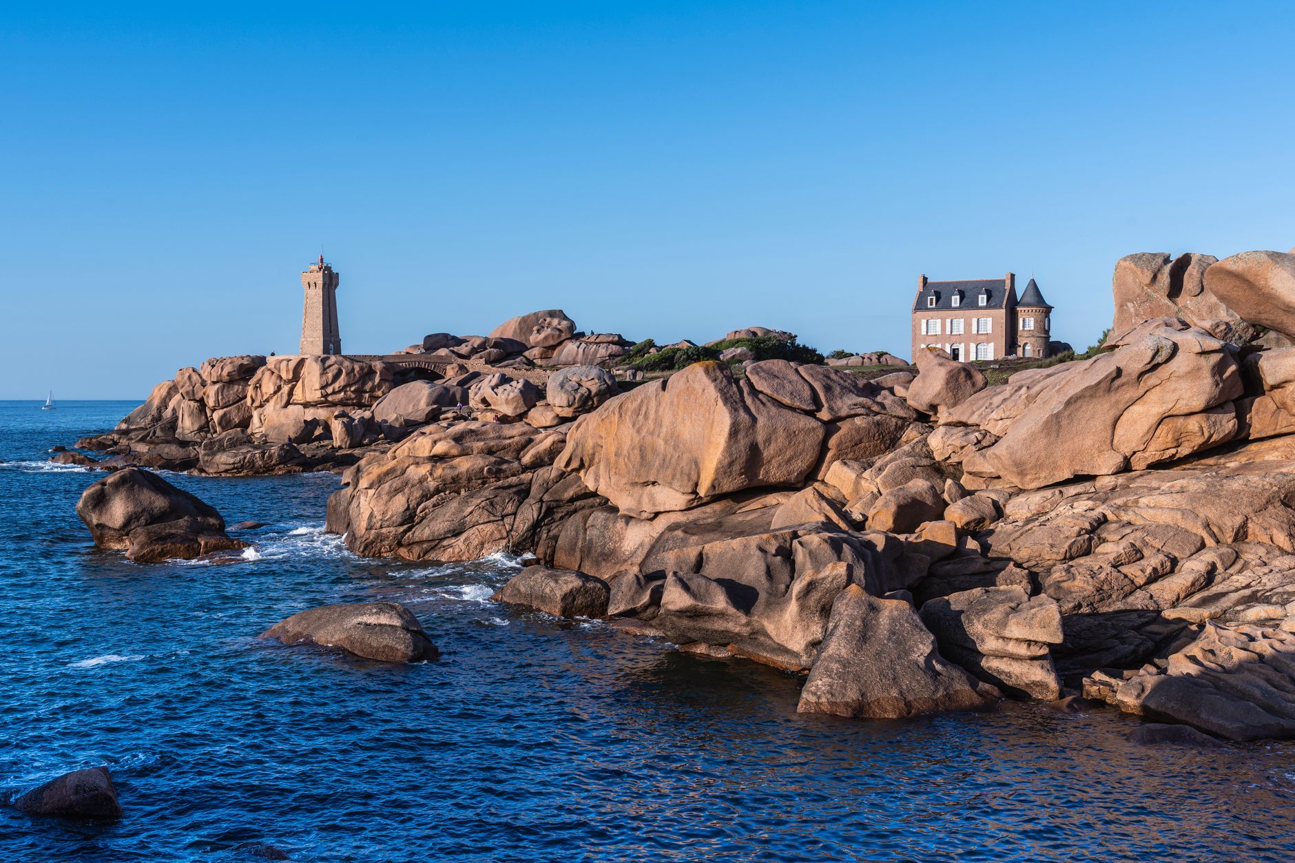
Start early on the Sentier des Douaniers, the old customs officers’ path that is now part of the GR34 coastal trail. Between Trestraou beach in Perros-Guirec and the port of Ploumanac’h it winds through piles of huge pink granite boulders, past the little Mean Ruz lighthouse, rebuilt after the war in pink stone. Allow two to three hours for the walk there and back.
Drive south-west past Morlaix, whose two-storey stone railway viaduct, 292 m long and opened in 1865, stands over the town centre. Continue to the Crozon peninsula and Pointe de Pen-Hir, where cliffs up to 70 m high face the four rocks of the Tas de Pois. Sleep in Camaret-sur-Mer, whose ochre Tour Vauban on the harbour wall is part of the Fortifications of Vauban, a UNESCO World Heritage Site since 2008.
Day 4 — Locronan and Pointe du Raz to Quimper (145 km)
Drive to Locronan, a village built of grey granite that grew rich weaving sailcloth in the 16th and 17th centuries; its square and church are almost unchanged, and it belongs to Les Plus Beaux Villages de France.
Then go west to the Pointe du Raz, a rocky point at the end of Cap Sizun with the sea crashing in on three sides. You park at the visitor centre and walk, or take the shuttle, about 800 m to the end; parking is paid in season. Drive back east to Quimper for the night. Its Saint-Corentin Cathedral is Gothic, begun in the 13th century, and its nave bends slightly in the middle.
Day 5 — Concarneau to Carnac (124 km)
Concarneau is a fishing port with a fortified old town, the Ville Close, on a small island in the harbour. Cross the bridge, walk the ramparts that Vauban strengthened in the 17th century, and continue east to Carnac.
Carnac has one of the largest groups of standing stones in the world: more than 3,000 menhirs set in long rows across the fields. The biggest group, Le Ménec, has 1,099 stones in 11 rows. In 2025 UNESCO listed the Megaliths of Carnac and of the Shores of Morbihan as a World Heritage Site. The fields are fenced to let the ground recover; from April to September you can walk inside only with a guided tour, and from October to March parts of them are open to wander freely. Sleep in Carnac.
Day 6 — Vannes back to Rennes (143 km)
Drive to Vannes on the Gulf of Morbihan. Its old town is still enclosed by ramparts built from the 13th century, with a row of slate-roofed washhouses along the river below them and streets of half-timbered houses inside. Then take the free voie express back to Rennes.
Costs
Use the cost calculator to price fuel and nights for your dates. There are no tolls on this route: Brittany’s main roads are free voies express. Budget for accommodation, fuel for about 820 km, car rental, parking at the Pointe du Raz in season, and entry to Fort La Latte and a guided visit at Carnac if you go in summer. Saint-Malo is very busy in July and August, so book a room early and leave the car outside the walls.
This trip is also in the free Roadcut trip planner: change the number of days and where you sleep each night, pick your vehicle to see the fuel cost, check the weather on the road, and open each day in Google Maps, Apple Maps or Waze.
Where to stay on this route
Night by night, in the towns this itinerary sleeps in.
- Night 1Hotels in Saint-Malo →
- Night 2Hotels in Perros-Guirec →
- Night 3Hotels in Camaret-sur-Mer →
- Night 4Hotels in Quimper →
- Night 5Hotels in Carnac →
The search opens with sample dates a month from today — change them to yours on Booking. Affiliate link — we may earn a commission at no extra cost to you.
The route on video
Get this itinerary by email
The days and the nights in your inbox, with a link back here when you are ready to book.
We use your address only to send this itinerary, unless you tick the box. Privacy
⚡ By electric car on this route
399 charging stations within 1.5 km of the road, 236 of them fast (DC). Most powerful: 400 kW.
Longest stretch without a fast charger tagged: 55 km, from km 476 of the route.
According to OpenStreetMap and operators’ websites. Fast = a DC plug or 50 kW and more; not every station has its power filled in, so there may be more. Power and stations missing from OpenStreetMap also from data.gouv.fr — IRVE (Licence Ouverte 2.0). See them on the planner map → · EV charging →
🚦 Know before you go
Vignette · Tolls · Good to know
Vignette. France has no vignette. Its autoroutes charge tolls, but Brittany's main roads are free voies express, so this loop needs neither.
Tolls. No tolls anywhere on this loop. Drivers coming from Paris pay the last motorway toll at La Gravelle on the A81, just before the border of Brittany.
Good to know. Parking at the Pointe du Raz is paid in season, and from the car park it is about 800 m to the point on foot or by shuttle. At Carnac the stone rows can be visited only on a guided tour from April to September; from October to March parts of them are open to walk freely. In Saint-Malo, leave the car outside the walls.
Estimate your exact costs in the cost calculator. Prices are approximate — check official sites before you travel. Some links are affiliate links.
Seen on the road
Travellers who drove these roads and filmed them.
Plan this trip
Where to sleep
Hotels & B&Bs →Holiday homes & apartments →Campsites (bookable) →Campervan & overnight spots →Tours & tickets
Find things to do →Affiliate link — we may earn a commission at no extra cost to you.
New road trips in your inbox
One email when we publish a new European route — the full guide, map and real costs. No spam, unsubscribe anytime.