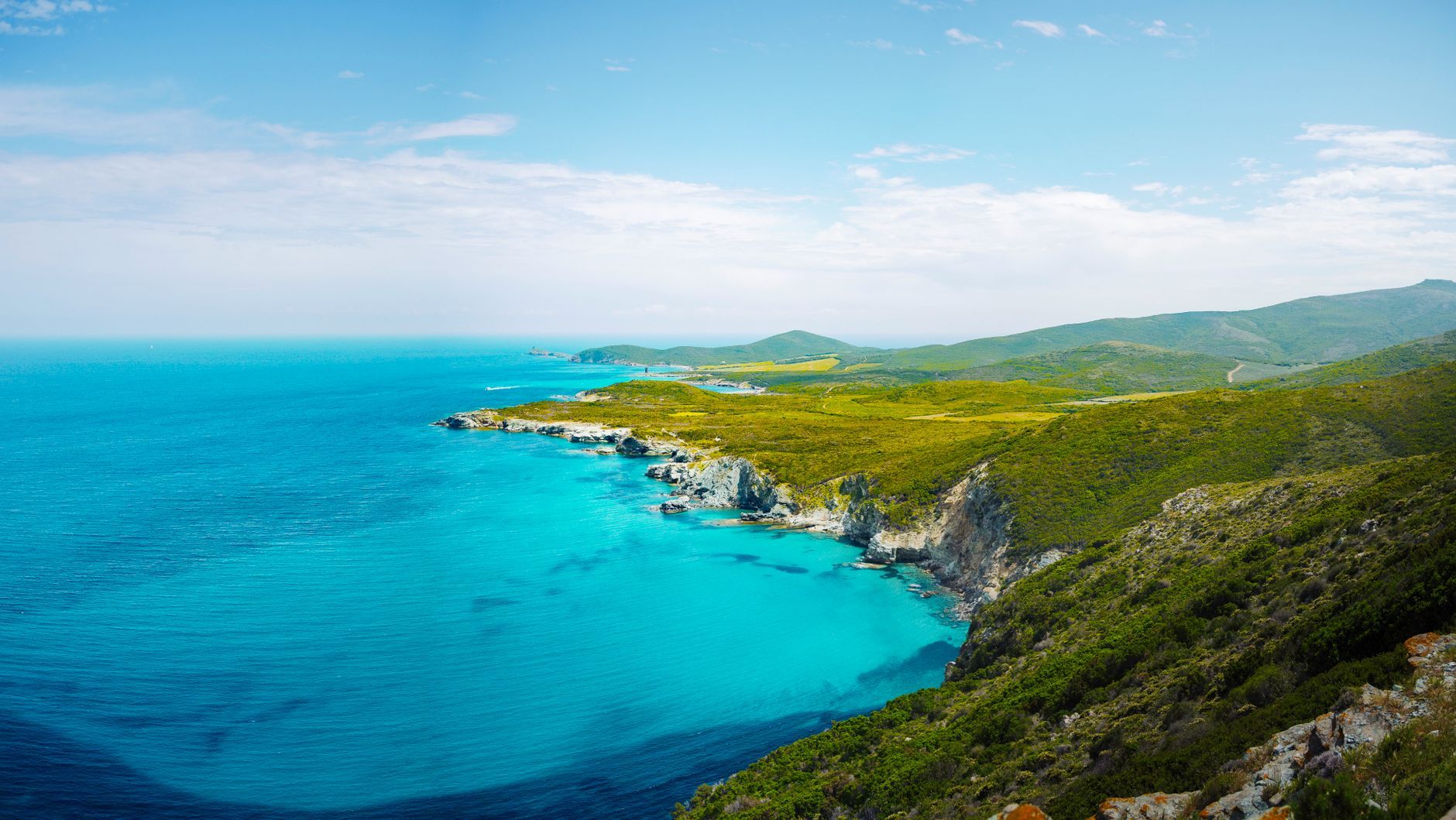
Northern Corsica Road Trip from Bastia: Cap Corse, the Agriates and Calvi in 4 Days
A 285 km drive across northern Corsica from Bastia to Calvi in four days — Erbalunga, the Moulin Mattei and Centuri on Cap Corse, the black beach at Nonza, the Patrimonio vineyards, Saint-Florent, the edge of the Agriates, Île-Rousse and the hill villages of the Balagne.
Rough estimate — fuel + nights at typical rates. Get an exact figure in the calculator.
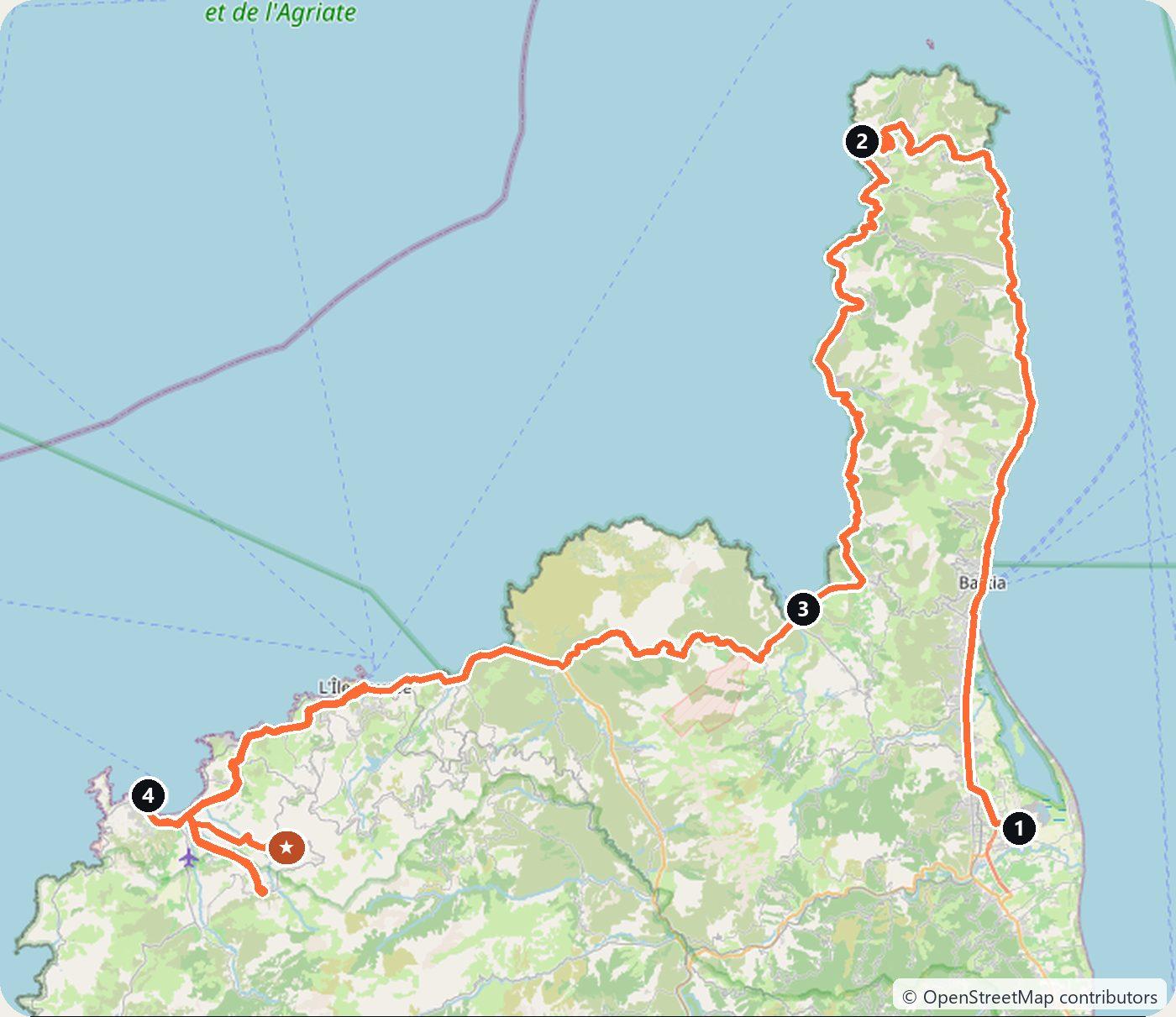
This drive covers the north of Corsica, the part the trip from Ajaccio to Bonifacio leaves out. It starts in Bastia, goes round Cap Corse, the long finger of mountains pointing north at the top of the island, and then follows the coast west past Saint-Florent and the empty Désert des Agriates to Île-Rousse and Calvi. The last day is a loop through the hill villages of the Balagne behind Calvi. It makes about 285 km in four days.
Corsica has no motorways, so there are no tolls, but the roads are slow: the road round Cap Corse is narrow and winds along the cliffs, which is why the days are short. The trip is one way and ends in Calvi, which has its own airport. If you have to bring the car back to Bastia, it is about 90 km from Calvi.
Day 1 — Bastia, Erbalunga and Macinaggio to Centuri (84 km)
Pick up the car at Bastia-Poretta airport, south of the town, and drive into Bastia. Walk round the Vieux-Port, the old harbour under the church of Saint-Jean-Baptiste, and climb to the citadel, Terra Nova, where the old palace of the Genoese governors now holds the Musée de Bastia, the town museum.
Drive north up the east coast of the cape to Erbalunga, a fishing village in the commune of Brando with the ruins of a 16th-century Genoese tower on the point beside its little harbour. Painters came here in the 1930s. Continue to Macinaggio, a small port near the tip of the cape. It is the start of the Sentier des Douaniers, the old customs officers’ path along the north coast; the first stretch, to Barcaggio, takes about three hours on foot.
The road then crosses the top of the cape to the Col de la Serra and the Moulin Mattei, a windmill from the end of the 18th century. In the 1930s the Mattei family restored it as an advertisement for their Cap Corse Mattei aperitif, and the Conservatoire du littoral now looks after it. The view takes in the island of Giraglia to the north. Drive down to Centuri, a fishing port known for its spiny lobster, and sleep there.
Day 2 — Nonza and Patrimonio to Saint-Florent (62 km)
Drive south down the west coast of the cape to Nonza, a village on a cliff more than 100 m above the sea. On the rock above it stands a square watchtower that Pasquale Paoli had built in 1760. Below the village lies a long beach of black pebbles: it is made of waste rock from the Canari asbestos quarry a few kilometres north, which closed in 1965. A path of steps goes down to it from the village.
Continue to Patrimonio, in the vineyards above the Gulf of Saint-Florent. In 1968 it became the first wine of Corsica with its own appellation (AOC); several estates along the road open for tastings. Then drive down to Saint-Florent for the night. The town grew up round a Genoese citadel built from 1440. Just outside the town, among the fields, stands the old cathedral of the Nebbio, Santa Maria Assunta, a Romanesque church in the Pisan style from the 12th century.
Day 3 — The Agriates and Île-Rousse to Calvi (73 km)
In season, boats leave the harbour of Saint-Florent for the beach of Lotu on the coast of the Désert des Agriates, a trip of about 20 to 30 minutes. The more famous beach of Saleccia, about 1 km of white sand, lies further west; by car it is reached only by a dirt track about 12 km long from Casta, and a 4x4 is recommended. The Agriates are almost empty, only scrub and rocks; since 1979 the Conservatoire du littoral has bought up the coast to protect it.
Back in the car, the D81 crosses the southern edge of the Agriates through Casta to the valley of the Ostriconi. Leave the car at the car park above the Ostriconi beach and walk about 15 minutes through the dunes to the sea. Then drive on to Île-Rousse, a town that Pasquale Paoli founded in 1758 as a Corsican port to rival Genoese Calvi; it is named after the red rocks of the Pietra islets off the harbour. Walk round Place Paoli and the covered market.
Continue along the coast to Calvi and sleep there. The Genoese citadel stands on a rock above the harbour. During the British siege of 1794, Horatio Nelson lost the sight of his right eye here.
Day 4 — The Balagne villages back to Calvi (66 km)
Spend the last day inland in the Balagne, the hills of olive groves and old villages behind Calvi. Drive first to Calenzana, where the GR20, the long-distance path across the mountains of Corsica, begins. Then take the small roads north-east through Montemaggiore to Sant’Antonino, a village of stone houses on top of a hill, one of Les Plus Beaux Villages de France. Cars stay below: park at the foot of the village and walk up.
Next door, Pigna is a restored village of craft workshops, also closed to cars. Come back towards the coast through Lumio and finish in Calvi, where you can return the car at Calvi-Sainte-Catherine airport.
Costs
Use the cost calculator to price fuel and nights for your dates. There are no tolls anywhere on this route: Corsica has no motorways. Budget for accommodation, fuel for about 285 km, car rental, and a one-way fee if you pick up the car in Bastia and leave it in Calvi; check it before you book. Add the boat from Saint-Florent to the Agriates beaches, entry to the Musée de Bastia, and parking in Bastia and Calvi. Cap Corse, Saint-Florent and Calvi are very busy in July and August, so book rooms early.
This trip is also in the free Roadcut trip planner: change the number of days and where you sleep each night, pick your vehicle to see the fuel cost, check the weather on the road, and open each day in Google Maps, Apple Maps or Waze.
Where to stay on this route
Night by night, in the towns this itinerary sleeps in.
- Night 1Hotels in Centuri →
- Night 2Hotels in Saint-Florent →
- Night 3Hotels in Calvi →
The search opens with sample dates a month from today — change them to yours on Booking. Affiliate link — we may earn a commission at no extra cost to you.
The route on video
Get this itinerary by email
The days and the nights in your inbox, with a link back here when you are ready to book.
We use your address only to send this itinerary, unless you tick the box. Privacy
⚡ By electric car on this route
71 charging stations within 1.5 km of the road, 28 of them fast (DC). Most powerful: 300 kW.
Longest stretch without a fast charger tagged: 36 km, from km 60 of the route.
According to OpenStreetMap and operators’ websites. Fast = a DC plug or 50 kW and more; not every station has its power filled in, so there may be more. Power and stations missing from OpenStreetMap also from data.gouv.fr — IRVE (Licence Ouverte 2.0). See them on the planner map → · EV charging →
🚦 Know before you go
Tolls · Ferries · Good to know
Tolls. No tolls anywhere on this route. France charges tolls on its autoroutes, but Corsica has no motorways at all, so every road here is free.
Ferries. No ferry is needed for the route. Bastia and Calvi both have airports, so renting on the island is the simple option; bringing your own car means a ferry to Bastia, for example from Livorno, Savona, Genoa, Nice, Toulon or Marseille. The Agriates beaches of Lotu and Saleccia are easiest to reach by passenger boat from Saint-Florent in season.
Good to know. The trip is one way, from Bastia to Calvi, so check the one-way fee before you book, or allow about 90 km to drive back to Bastia. The road round Cap Corse is narrow and slow. The track to Saleccia beach is unpaved and a 4x4 is recommended; Sant'Antonino and Pigna are closed to cars, so park at the foot of each village.
Estimate your exact costs in the cost calculator. Prices are approximate — check official sites before you travel. Some links are affiliate links.
Seen on the road
Travellers who drove these roads and filmed them.
Plan this trip
Where to sleep
Hotels & B&Bs →Holiday homes & apartments →Campsites (bookable) →Campervan & overnight spots →Tours & tickets
Find things to do →Affiliate link — we may earn a commission at no extra cost to you.
Drive on from here
More roads nearby
New road trips in your inbox
One email when we publish a new European route — the full guide, map and real costs. No spam, unsubscribe anytime.