Tre Cime di Lavaredo: Toblach to Cortina via Misurina (2 Days)
Two days and about 50 km from Toblach to Cortina d'Ampezzo past Dürrensee and Lake Misurina, up the toll road to the Three Peaks, round them on foot and over Passo Tre Croci. Best late May–October.
Rough estimate — fuel + nights at typical rates. Get an exact figure in the calculator.
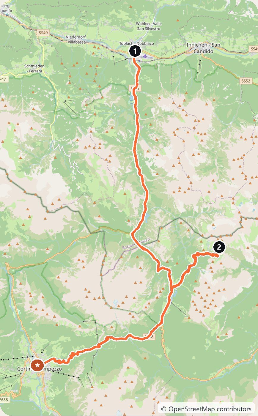
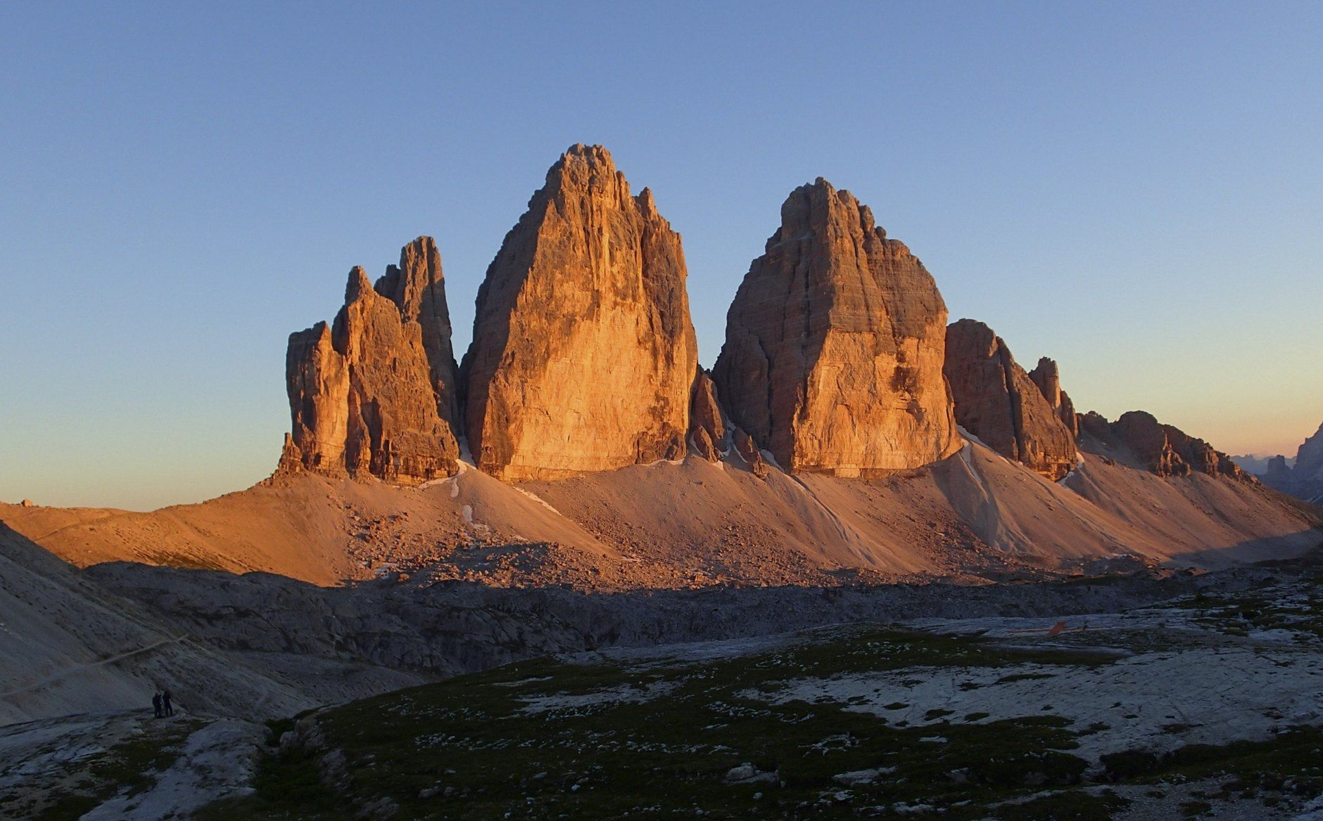
The Tre Cime di Lavaredo (Drei Zinnen, the Three Peaks) are the most famous rock towers in the Dolomites, a UNESCO World Heritage Site. This short drive starts in Toblach (Dobbiaco) in South Tyrol, runs south through the Höhlensteintal past two mountain lakes to Lake Misurina, climbs a toll road to the car park at Rifugio Auronzo right under the peaks, and finishes the next day in Cortina d’Ampezzo over Passo Tre Croci. It is only about 50 km, but the walk round the peaks takes half a day, so give it two.
Italy drives on the right. The toll road to Rifugio Auronzo is open roughly from late May to late October, weather permitting, and must be booked online in advance; outside that season you can still drive Toblach–Misurina–Cortina, but not up to the peaks. Winter tyres or snow chains on board are required on signposted roads, usually 15 November to 15 April.
Day 1 — Toblach to Rifugio Auronzo (27 km)
From Toblach drive south on the SS51 into the Höhlensteintal, past the Toblacher See (Lago di Dobbiaco) and the shallow Dürrensee (Lago di Landro, 1,406 m) under Monte Cristallo. At the head of the valley turn off for Misurina: its lake (1,754 m) is one of the classic views of the Tre Cime. From Misurina the toll road climbs past Lake Antorno to the large car park at Rifugio Auronzo (about 2,330 m), at the foot of the peaks. Sleep at Rifugio Auronzo (book ahead), back down in Misurina, or in a motorhome in the car park.
Day 2 — Round the Tre Cime and on to Cortina d’Ampezzo (22 km)
Start early with the circuit of the Tre Cime: about 10 km and 3½–4 hours on foot, past Rifugio Lavaredo, over Forcella Lavaredo to Rifugio Locatelli (Dreizinnenhütte) facing the famous north faces, and back via Malga Langalm. Then drive back down to Misurina and over Passo Tre Croci (about 1,800 m) into Cortina d’Ampezzo, the elegant mountain town at the end of the road.
Costs
Use the cost calculator to price fuel and nights for your dates. The toll road to Rifugio Auronzo cost €40 for a car, €26 for a motorbike and €60 for a motorhome in 2026, booked online at pass.auronzo.info with your number plate; the ticket is valid for 12 hours from the entry time you book, and a stay of more than 12 hours (a night in a motorhome) needs two slots. In a motorhome you may sleep in the car park but not camp: no tables, chairs or awnings. In summer the Dolomiti Bus shuttle from Misurina to Rifugio Auronzo costs €10 per person and saves the toll. Mountain huts and hotels around Misurina and Cortina are often €90–200+ per night in season; book early.
Optional detour: Lago di Braies
Lago di Braies (Pragser Wildsee) is about 16 km west of Toblach. In summer the valley road is regulated: in 2026 from 1 July to 15 September, 9:00–16:00, you could only drive in with an online booking, by public transport, on foot or by bike. Check prags.bz before you go.
This trip is also in the free Roadcut trip planner: change the number of days and where you sleep each night, pick your vehicle to see the fuel cost, check the weather on the road, and open each day in Google Maps, Apple Maps or Waze.
Where to stay on this route
Night by night, in the towns this itinerary sleeps in.
- Night 1Hotels in Misurina →
The search opens with sample dates a month from today — change them to yours on Booking. Affiliate link — we may earn a commission at no extra cost to you.
The route on video
Get this itinerary by email
The days and the nights in your inbox, with a link back here when you are ready to book.
We use your address only to send this itinerary, unless you tick the box. Privacy
⚡ By electric car on this route
16 charging stations within 1.5 km of the road, 6 of them fast (DC). Most powerful: 300 kW.
Longest stretch without a fast charger tagged: 38 km, from km 1 of the route.
According to OpenStreetMap and operators’ websites. Fast = a DC plug or 50 kW and more; not every station has its power filled in, so there may be more. See them on the planner map → · EV charging →
🚦 Know before you go
Vignette · Tolls · Good to know
Vignette. Italy has no vignette. If you drive in on Austrian motorways (for example over the Brenner), Austria requires a motorway vignette — buy it before the border.
Tolls. The roads from Toblach to Misurina and Cortina (SS51, SR48) are toll-free. The private toll road from Misurina to Rifugio Auronzo cost €40 for a car, €26 for a motorbike and €60 for a motorhome in 2026, booked online in advance at pass.auronzo.info; the ticket is valid for 12 hours from the booked entry time. Italian autostrada tolls apply only if you reach the area by motorway (e.g. the A22 to Bolzano).
Good to know. The toll road to the Tre Cime is open roughly from late May to late October, weather permitting, and needs an online booking with your number plate — without one you cannot drive up. In summer the Dolomiti Bus shuttle from Misurina (€10 per person) avoids the toll. Motorhomes may sleep in the Auronzo car park but not camp (no tables, chairs or awnings); more than 12 hours needs two slots. Start the walk round the peaks early: the car park fills in July and August.
Estimate your exact costs in the cost calculator. Prices are approximate — check official sites before you travel. Some links are affiliate links.
Seen on the road
Travellers who drove these roads and filmed them.
Plan this trip
Where to sleep
Hotels & B&Bs →Holiday homes & apartments →Campsites (bookable) →Campervan & overnight spots →Tours & tickets
Find things to do →Affiliate link — we may earn a commission at no extra cost to you.
Drive on from here
More roads nearby
New road trips in your inbox
One email when we publish a new European route — the full guide, map and real costs. No spam, unsubscribe anytime.