High Coast Road Trip from Sundsvall: Skuleberget, Skuleskogen and Ulvön in 3 Days
A 396 km loop through Sweden's High Coast from Sundsvall in three days — the High Coast Bridge, the diabase shore of Rotsidan, Skuleberget, the Slåttdalsskrevan gorge in Skuleskogen National Park, Örnsköldsvik and a boat to the fishing village on Ulvön.
Rough estimate — fuel + nights at typical rates. Get an exact figure in the calculator.
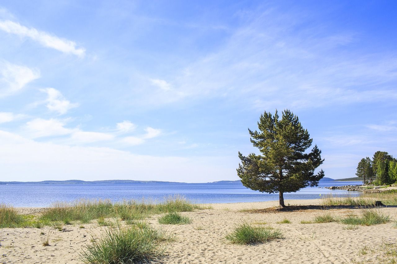
The High Coast, Höga kusten in Swedish, is a stretch of Sweden’s coast on the Gulf of Bothnia, north of Sundsvall, where high hills meet the sea. When the ice sheet melted, the land here, freed of its weight, began to rise, and it has risen about 286 m since the ice left some 10,500 years ago. It is still rising, by close to a centimetre a year. This is why the High Coast became a UNESCO World Heritage Site in 2000; in 2006 the Kvarken Archipelago in Finland, across the water, was added to it.
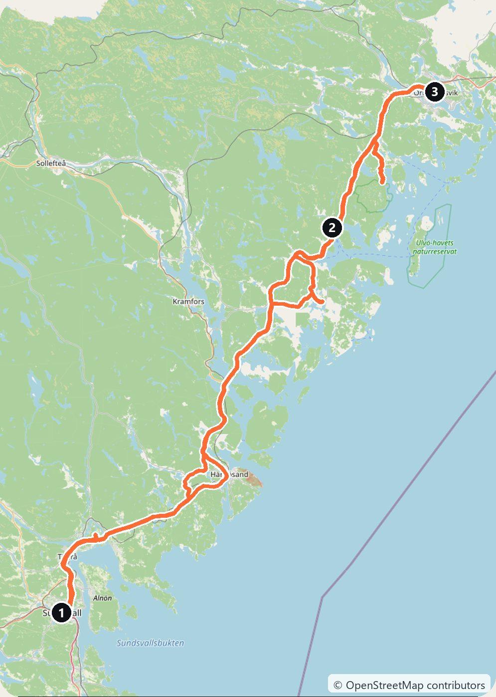
This loop starts in Sundsvall, crosses the High Coast Bridge, takes you to the rock shore of Rotsidan, up Skuleberget, into Skuleskogen National Park and out by boat to the island of Ulvön. It makes about 396 km in three days and comes back to Sundsvall. Bring good walking shoes: the best of the High Coast is reached on foot.
Day 1 — Sundsvall, the High Coast Bridge and Nordingrå to Docksta (175 km)
Pick up the car in Sundsvall, or at Sundsvall–Timrå Airport north of the city. After a great fire on 25 June 1888, the centre was rebuilt in stone and brick, and it is still called Stenstaden, the stone town.
Drive north on the E4 to the High Coast Bridge (Högakustenbron), a suspension bridge over the mouth of the river Ångermanälven, opened in 1997. It is 1,867 m long, with a main span of 1,210 m. Stop on the northern side at Hornöberget, where there is a hotel and the High Coast Trail begins, for the view over the bridge and the river mouth.
Leave the E4 for the Nordingrå peninsula, a quiet land of hills, lakes and small villages. From Nordingrå follow the signs over Häggvik and Kåsta to Fällsvik, then a forest road to the car park of Rotsidan, a nature reserve where about 4 km of shore is made of smooth, flat slabs of dark diabase, washed by the sea and edged with fields of round stones. The rock is very slippery at the water’s edge. Then drive north past Mjällom to Docksta and sleep there, at the foot of Skuleberget.
Day 2 — Skuleberget and Skuleskogen to Örnsköldsvik (57 km)
Start at Skuleberget, a 295 m hill beside the E4 just north of Docksta, with a cliff face about 250 m high on its east side. When the ice melted, this land lay pressed down at sea level; the shore of that time is now 286 m above today’s sea, the highest old shoreline in Sweden. Begin at Naturum Höga Kusten, the World Heritage visitor centre at its foot; entry is free, but it is not open in winter, so check the times. From there Grottstigen is the shortest and steepest path to the top, 600 m and 30 to 40 minutes up; longer paths of about 2.5 km climb more gently. In summer a lift runs to the top from the west side of the hill, except in strong wind. On the east side is Kungsgrottan, a round cave that the waves probably hollowed out when this part of the hill still lay at sea level.
Then drive to the southern entrance (Entré Syd) of Skuleskogen National Park, founded in 1984: about 3,000 hectares of forest, cliffs and lakes with no roads. The main sight is Slåttdalsskrevan, a narrow gorge about 200 m long and only about 7 m wide that cuts right through the mountain. It is about 4 km each way from the entrance, with steep climbs, so allow most of the afternoon. Since 2023 you can no longer walk through the gorge, because of falling rocks; the new trail goes around it on the west side instead (not over Slåttdalsberget, which rises east of the gorge) and comes down just south of it; you look into the gorge from its north and south ends. Drive on to Örnsköldsvik for the night. The High Coast Trail from the bridge ends here, on Varvsberget.
Day 3 — Köpmanholmen and Ulvön back to Sundsvall (164 km)
Drive south to Köpmanholmen and leave the car in the paid car park by the harbour: no ferry to Ulvön takes cars. The M/F Ulvön sails from here all year, also serving the island of Trysunda, and takes about 1.5 hours to Ulvöhamn. There are only a few sailings a day, fewer outside summer, so check the timetable and your return boat before you go. In summer, boats also run to Ulvön from Ullånger, Docksta and Mjällomslandet.
Ulvöhamn is an old fishing village on the island. Its little wooden chapel dates from 1622; fishermen from Gävle built it, and its walls and ceiling are painted inside. Climb Lotsberget above the village for the view over the harbour and the islands. Take the afternoon boat back to Köpmanholmen and drive the E4 south, over the High Coast Bridge again, to Sundsvall.
Costs
Use the cost calculator to price fuel and nights for your dates. There are no tolls on this loop: Sweden has no vignette and no motorway tolls for cars, and the High Coast Bridge is free. The only toll near the route is the Sundsvall Bridge, which carries the E4 past the centre of Sundsvall: SEK 9 a crossing for a car, charged by camera. This loop does not cross it, but you will if you drive through Sundsvall on the E4. Budget for accommodation, fuel for about 396 km, car rental, the boat to Ulvön, parking at Köpmanholmen, and the Skuleberget lift if you take it. In winter the forest road to Rotsidan is not ploughed and the boats sail less often, so the route is best from late spring to early autumn.
This trip is also in the free Roadcut trip planner: change the number of days and where you sleep each night, pick your vehicle to see the fuel cost, check the weather on the road, and open each day in Google Maps, Apple Maps or Waze.
Where to stay on this route
Night by night, in the towns this itinerary sleeps in.
- Night 1Hotels in Docksta →
- Night 2Hotels in Örnsköldsvik →
The search opens with sample dates a month from today — change them to yours on Booking. Affiliate link — we may earn a commission at no extra cost to you.
The route on video
Get this itinerary by email
The days and the nights in your inbox, with a link back here when you are ready to book.
We use your address only to send this itinerary, unless you tick the box. Privacy
⚡ By electric car on this route
77 charging stations within 1.5 km of the road, 46 of them fast (DC). Most powerful: 400 kW.
Longest stretch without a fast charger tagged: 67 km, from km 91 of the route.
According to OpenStreetMap and operators’ websites. Fast = a DC plug or 50 kW and more; not every station has its power filled in, so there may be more. Power and stations missing from OpenStreetMap also from NOBIL by Enova (CC BY 4.0). See them on the planner map → · EV charging →
🚦 Know before you go
Vignette · Tolls · Bridges & tunnels · Ferries · Good to know
Vignette. Sweden has no vignette for cars, so this loop needs none.
Tolls. No tolls anywhere on this loop; Swedish motorways are free for cars, and so is the High Coast Bridge. The Sundsvall Bridge, which carries the E4 past the centre of Sundsvall, charges SEK 9 a crossing for a car, by camera, but the loop does not use it.
Bridges & tunnels. The High Coast Bridge on the E4 over the mouth of the Ångermanälven is a toll-free suspension bridge, 1,867 m long; you cross it on the first and the last day.
Ferries. No car ferry is needed. Ulvön is reached by passenger boat only: the M/F Ulvön sails all year from Köpmanholmen, about 1.5 hours to Ulvöhamn, with only a few sailings a day, and in summer boats also run from Ullånger, Docksta and Mjällomslandet. Leave the car in the harbour car park, which is paid at Köpmanholmen.
Good to know. Since 2023 you cannot walk through the Slåttdalsskrevan gorge because of falling rocks; you look into it from its north and south ends, about 4 km on foot each way from the southern entrance of Skuleskogen. In winter the forest road to Rotsidan is not ploughed, Naturum Höga Kusten is closed and the boats to Ulvön sail less often.
Estimate your exact costs in the cost calculator. Prices are approximate — check official sites before you travel. Some links are affiliate links.
Seen on the road
Travellers who drove these roads and filmed them.
Plan this trip
Where to sleep
Hotels & B&Bs →Holiday homes & apartments →Campsites (bookable) →Campervan & overnight spots →Tours & tickets
Find things to do →Affiliate link — we may earn a commission at no extra cost to you.
New road trips in your inbox
One email when we publish a new European route — the full guide, map and real costs. No spam, unsubscribe anytime.