Alta to the North Cape Road Trip: Rock Art, Nordkapp and Hammerfest in 3 Days
A 642 km drive from Alta Airport to the North Cape and back in three days — the UNESCO rock art at Alta, the E6 over Sennalandet, Repvåg, the North Cape Tunnel, Honningsvåg, the Nordkapp plateau, the hike to Knivskjellodden, the bird cliffs at Gjesværstappan and Hammerfest, with the winter convoy rules.
Rough estimate — fuel + nights at typical rates. Get an exact figure in the calculator.
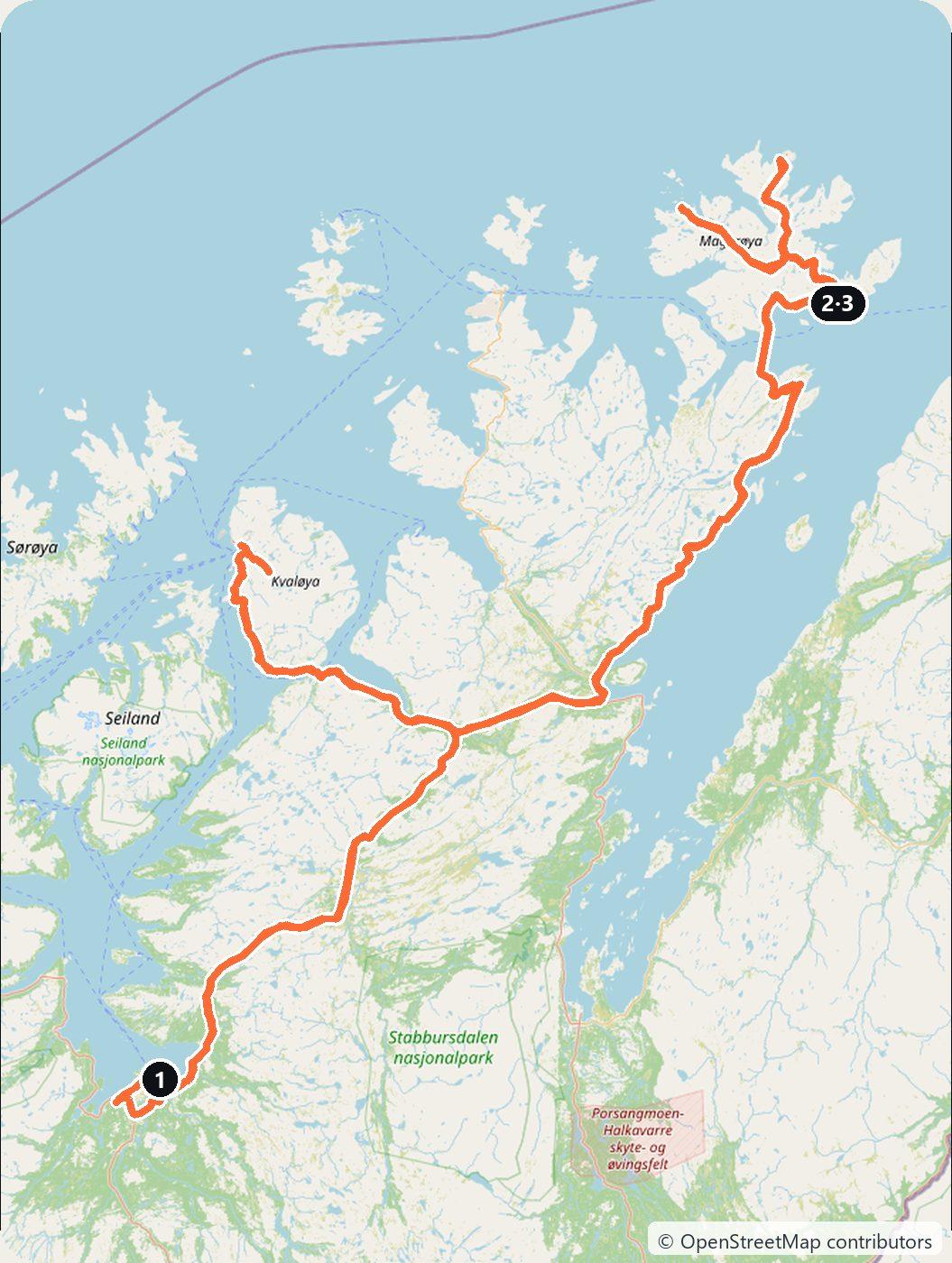
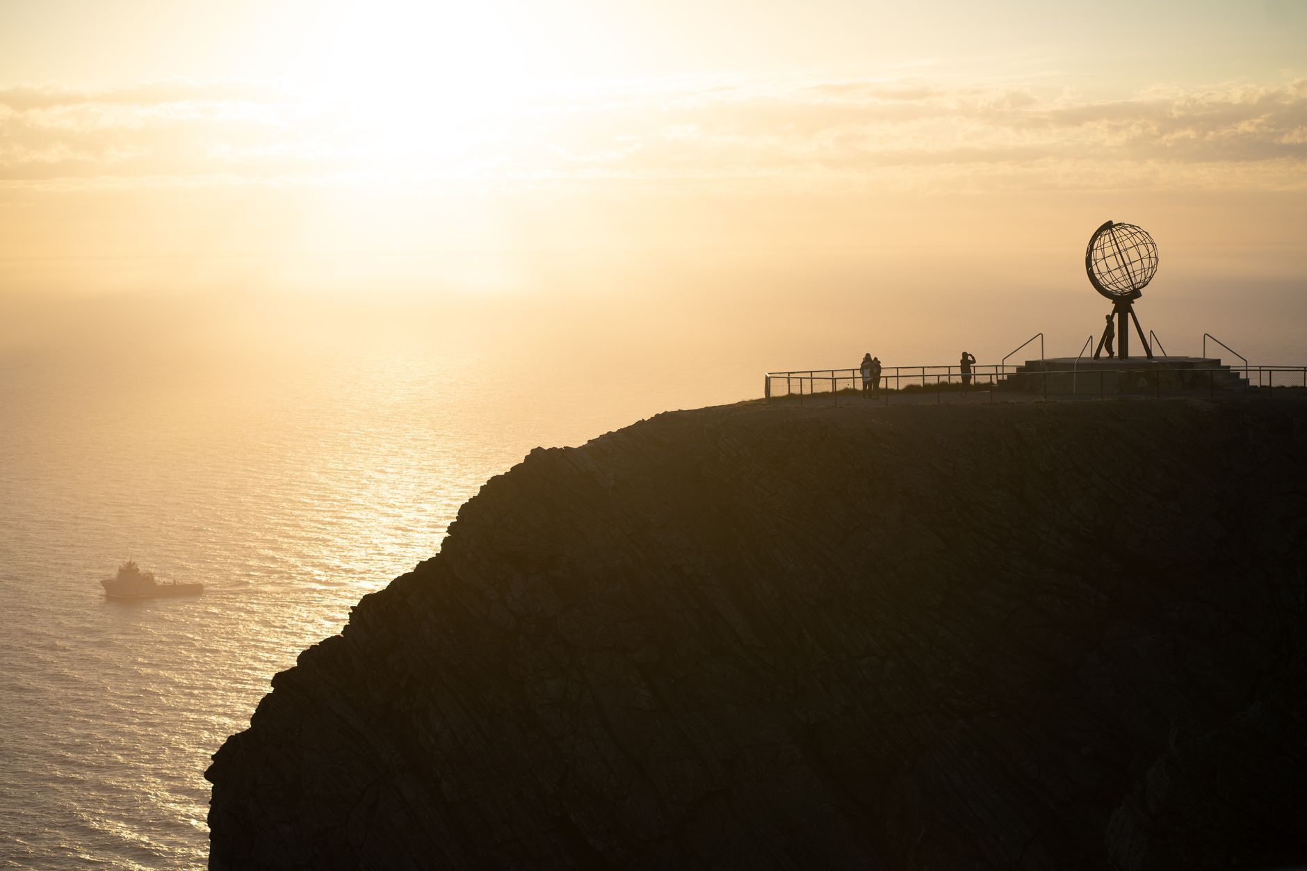
The North Cape (Nordkapp) is a cliff of 307 m on the island of Magerøya, at the top of Norway. Most drivers come up the E6 from the south over many days. This route takes the short way: fly to Alta, pick up a car at Alta Airport, and drive a loop through Finnmark — the rock art at Alta, the open plateau of Sennalandet, the Porsangerfjord past Repvåg, the North Cape Tunnel to Honningsvåg, a full day on Magerøya, and back via Hammerfest. It makes about 642 km in three days.
The best time is June to August. The midnight sun lasts in Honningsvåg from about 13 May to 31 July, the hiking trail and the bird boats are open, and the road to the plateau is free to drive at any hour. In winter the same trip is possible but different: the polar night lasts from about 21 November to 21 January, the outdoor sights are closed, and the last stretch to the North Cape is driven only in convoy. The days below are planned for summer, with winter notes.
Day 1 — Alta Airport, the rock art and Sennalandet to Honningsvåg (219 km)
Pick up the car at Alta Airport and drive to the west side of town, to the Alta Museum at Hjemmeluft. The first carvings here were found in 1973, and the Rock Art of Alta has been a UNESCO World Heritage Site since 1985. More than 6,000 figures have been found around the head of the fjord; the oldest are more than 7,000 years old. In the snow-free season, walk the trail along the rocks: the short loop is 1.2 km, the long one 3 km. In winter the path around the carvings is closed, and you see the boulders with carvings in the indoor exhibition. In 2026 the museum is open daily from 9 to 19 from 1 June to 21 August, shorter hours otherwise.
Then take the E6 north-east over Sennalandet, an open plateau between Alta and Skaidi. There are few services up there, so fill up in Alta. In winter storms, the E6 here and the E69 past Repvåg can also be driven in convoy at fixed times. At Olderfjord, turn onto the E69 and follow the west shore of the Porsangerfjord north. Stop at Repvåg, a fishing village of about 14 people that was once one of Finnmark’s main trading places for the trade with Russia.
Further on, the North Cape Tunnel (Nordkapptunnelen) takes you under the sea to Magerøya. It is 6.9 km long and goes down to 212 m below sea level, with slopes of up to 9%. It opened in 1999 and has been toll-free since 29 June 2012. Drive on to Honningsvåg, a small town and a stop of the Hurtigruten coastal ships, and sleep there.
Day 2 — Gjesvær, Knivskjellodden and the North Cape plateau, back to Honningsvåg (109 km)
Drive to Gjesvær on the north-west coast of the island. From here boats go out to the Gjesværstappan nature reserve, islands with bird cliffs that you watch from the boat. The local operator sails from early May to late August, several times a day from 10 June to 10 August.
Then drive back towards the North Cape and stop at the car park on the E69 where the trail to Knivskjellodden begins. This point reaches 1,450 m further north than the North Cape cliff, and it is the real northernmost point of the island. The marked trail is about 18 km there and back; allow about five hours, and bring wind and rain clothing. Walk it only in the snow-free season, roughly late spring to early autumn; it is not recommended in winter.
In the evening drive the last kilometres to the North Cape plateau. The North Cape Hall (Nordkapphallen), built in 1988, has exhibitions and a panorama film; entry is paid, so check the current price before you go. In summer, come at midnight to see the sun above the sea. Drive back to Honningsvåg for the night.
In winter, the E69 between the Skarsvåg junction and the plateau is driven only in convoy (kolonnekjøring) at fixed times. In winter 2025/26 the convoys left the Skarsvåg junction at 08:30, 10:00, 12:00, 14:30 and 19:30, and the plateau at 09:30, 11:00, 13:45, 16:15 and 21:30 (12:30 on Fridays). Convoys are free and need no booking; in bad weather the road closes altogether.
Day 3 — Honningsvåg to Hammerfest and back to Alta (314 km)
Drive back through the tunnel and down the E69 to Olderfjord, then west on the E6 to Skaidi and north to Hammerfest. German troops burned the town when they retreated in November 1944, and only a small funeral chapel survived. The Museum of Reconstruction (Gjenreisningsmuseet) tells how Finnmark was rebuilt after the war. On the point at Fuglenes stands the Meridian Column, set up in 1854 at the northern end of the Struve Geodetic Arc, a chain of survey points 2,820 km long that measured the shape of the Earth. It has been a UNESCO World Heritage Site since 2005.
Then drive back to Skaidi and over Sennalandet to Alta Airport. This is the longest day, more than five hours of driving, so start early.
Costs
Use the cost calculator to price fuel and nights for your dates. Norway has no vignette. We found no toll stations on this route in 2026, and the North Cape Tunnel has been free since 2012. If you extend the trip, Norwegian tolls are charged automatically through AutoPASS: a rental car is billed to the hire company, which passes the charges on to you; with your own foreign car, register it with Epass24 before you go, or the invoice is sent to the owner. Budget for accommodation, fuel for about 642 km, car rental, entry to the Alta Museum (NOK 175 for adults in summer 2026, NOK 115 in winter), the North Cape Hall and the Museum of Reconstruction, and the bird boat at Gjesvær. In Finnmark a tread depth of at least 3 mm is required from 16 October to 30 April, studded tyres are allowed in that period, and you must use winter tyres or chains whenever the road needs them; ask for winter tyres when you book a car between October and April.
This trip is also in the free Roadcut trip planner: change the number of days and where you sleep each night, pick your vehicle to see the fuel cost, check the weather on the road, and open each day in Google Maps, Apple Maps or Waze.
Where to stay on this route
Night by night, in the towns this itinerary sleeps in.
- Nights 1–2Hotels in Honningsvåg →
The search opens with sample dates a month from today — change them to yours on Booking. Affiliate link — we may earn a commission at no extra cost to you.
The route on video
Get this itinerary by email
The days and the nights in your inbox, with a link back here when you are ready to book.
We use your address only to send this itinerary, unless you tick the box. Privacy
⚡ By electric car on this route
27 charging stations within 1.5 km of the road, 20 of them fast (DC). Most powerful: 400 kW.
Longest stretch without a fast charger tagged: 168 km, from km 298 of the route.
According to OpenStreetMap and operators’ websites. Fast = a DC plug or 50 kW and more; not every station has its power filled in, so there may be more. Power and stations missing from OpenStreetMap also from NOBIL by Enova (CC BY 4.0). See them on the planner map → · EV charging →
🚦 Know before you go
Tolls · Good to know
Tolls. Norway has no vignette, and we found no toll stations on this route in 2026. The North Cape Tunnel (Nordkapptunnelen) on the E69 has been toll-free since 29 June 2012. Elsewhere in Norway tolls are read automatically from the number plate through AutoPASS: a rental car is billed to the hire company, which passes the charges on to you; with your own foreign-registered car, register it with Epass24 before the trip, or the invoice is sent to the vehicle owner, possibly with a lookup fee.
Good to know. The best season is June to August: midnight sun in Honningsvåg from about 13 May to 31 July, the Knivskjellodden trail snow-free and the Gjesvær bird boats running (early May to late August). In winter the E69 from the Skarsvåg junction to the North Cape plateau is driven only in free convoys at fixed times (in winter 2025/26 from Skarsvåg at 08:30, 10:00, 12:00, 14:30 and 19:30) and closes in bad weather; the polar night lasts from about 21 November to 21 January. In Finnmark a tread depth of at least 3 mm applies from 16 October to 30 April.
Estimate your exact costs in the cost calculator. Prices are approximate — check official sites before you travel. Some links are affiliate links.
Plan this trip
Where to sleep
Hotels & B&Bs →Holiday homes & apartments →Campsites (bookable) →Campervan & overnight spots →Tours & tickets
Find things to do →Affiliate link — we may earn a commission at no extra cost to you.
New road trips in your inbox
One email when we publish a new European route — the full guide, map and real costs. No spam, unsubscribe anytime.