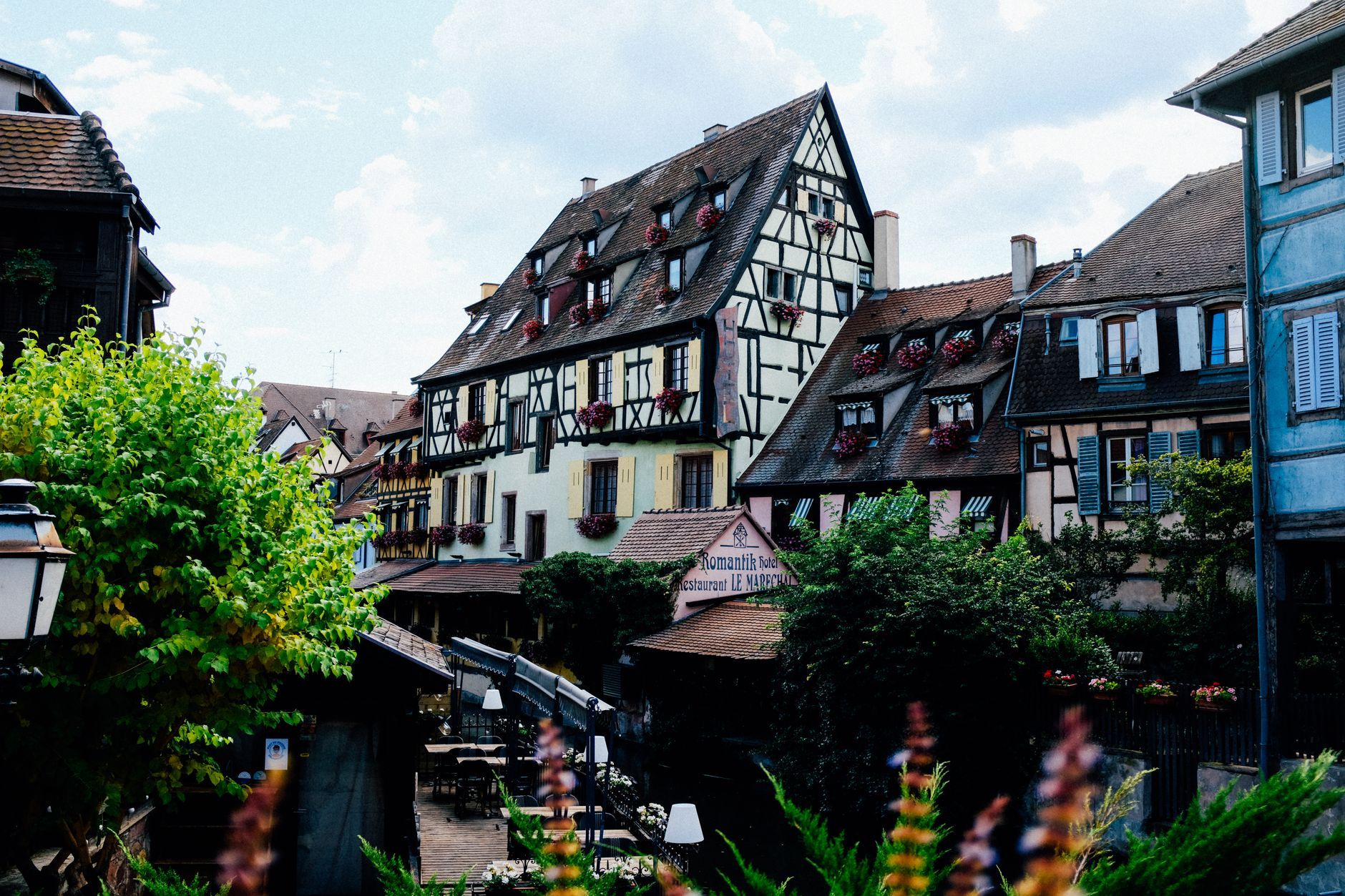
Alsace Wine Route Road Trip: Strasbourg to Colmar (3 Days)
A 3-day drive down the Alsace Wine Route from Strasbourg to Colmar — day-by-day villages, half-timbered towns, vineyards, real costs and the stops worth making.
Rough estimate — fuel + nights at typical rates. Get an exact figure in the calculator.
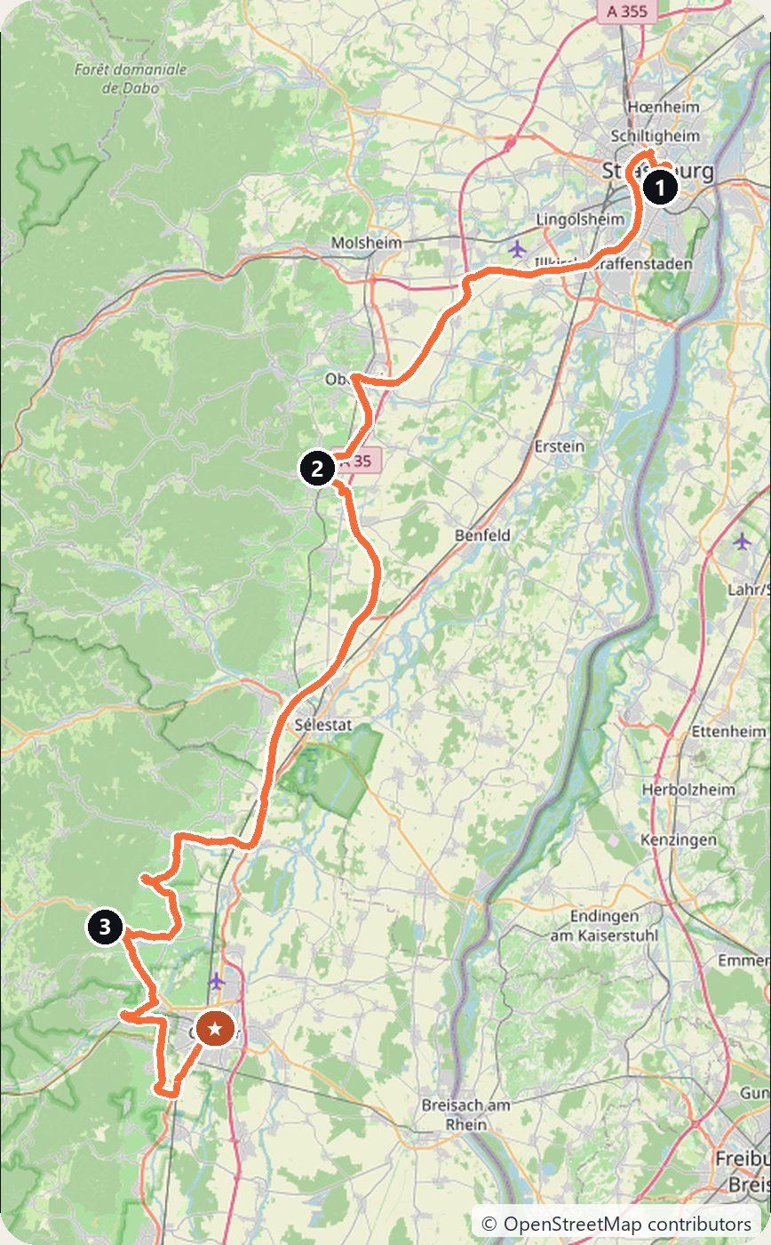
The Alsace Wine Route (Route des Vins d’Alsace) is one of France’s oldest signed wine roads, winding through vineyards along the eastern foot of the Vosges mountains. The full marked route runs roughly 170 km from Marlenheim to Thann, but its storybook heart lies between Strasbourg and Colmar — half-timbered villages, Riesling and Gewürztraminer, and cosy winstubs. Distances are short, so the driving is slow and the days are for wandering.
France drives on the right. There is no vignette, and the wine-route back roads are toll-free — you only pay a péage if you choose the A35 autoroute. Villages are lovely from spring to autumn; autumn brings the vendanges (grape harvest) and December brings the famous Christmas markets, though winter days are short and cold.
Day 1 — Strasbourg to Barr (35 km)
Start in Strasbourg, wandering the UNESCO-listed Grande Île and the pink-sandstone cathedral with its astronomical clock. Then head south into the vineyards. Pause in Obernai, a walled market town beneath Mont Sainte-Odile, and finish in Barr, a quieter wine village known for its Sylvaner and grand cru vineyards. Overnight in Barr or Obernai.
Day 2 — Barr to Kaysersberg (50 km)
The classic day. Roll south through the vines to Ribeauvillé, watched over by ruined castles, then Riquewihr, a near-perfectly preserved medieval village ringed by ramparts. Finish in Kaysersberg, birthplace of Albert Schweitzer, with its fortified bridge and half-timbered lanes. Tastings in the caves along the way are often free or a small fee. Sleep in or near Kaysersberg.
Day 3 — Kaysersberg to Colmar (35 km)
A short, scenic finish. Detour to Turckheim, still walked by a nightwatchman on summer evenings, and to Eguisheim — one of France’s officially “most beautiful villages”, laid out in concentric lanes around a central château. Then arrive in Colmar: the canals of Petite Venise, half-timbered houses and the Unterlinden Museum. A fitting end to the route.
Costs
Use the cost calculator to price fuel and nights for your exact dates. Expect roughly €90–160 per night for accommodation in the wine villages, more in Colmar and during December markets. Fuel is modest over just 120 km, and there are no tolls on the route itself. Budget a little for village parking (often paid in the centres) and for wine tastings — many caves pour for free or a few euros, sometimes waived if you buy a bottle. Booking rooms early matters most in autumn and December.
This trip is also in the free Roadcut trip planner: change the number of days and where you sleep each night, pick your vehicle to see the fuel cost, check the weather on the road, and open each day in Google Maps, Apple Maps or Waze.
Where to stay on this route
Night by night, in the towns this itinerary sleeps in.
The search opens with sample dates a month from today — change them to yours on Booking. Affiliate link — we may earn a commission at no extra cost to you.
The route on video
Get this itinerary by email
The days and the nights in your inbox, with a link back here when you are ready to book.
We use your address only to send this itinerary, unless you tick the box. Privacy
⚡ By electric car on this route
85 charging stations within 1.5 km of the road, 48 of them fast (DC). Most powerful: 400 kW.
Longest stretch without a fast charger tagged: 18 km, from km 73 of the route.
According to OpenStreetMap and operators’ websites. Fast = a DC plug or 50 kW and more; not every station has its power filled in, so there may be more. Power and stations missing from OpenStreetMap also from data.gouv.fr — IRVE (Licence Ouverte 2.0). See them on the planner map → · EV charging →
Seen on the road
Travellers who drove these roads and filmed them.
Plan this trip
Where to sleep
Hotels & B&Bs →Holiday homes & apartments →Campsites (bookable) →Campervan & overnight spots →Tours & tickets
Find things to do →Affiliate link — we may earn a commission at no extra cost to you.
Drive on from here
New road trips in your inbox
One email when we publish a new European route — the full guide, map and real costs. No spam, unsubscribe anytime.