Galway to Dingle Drive: Wild Atlantic Way, 340 km, 4 Days
Drive the Wild Atlantic Way from Galway to the Dingle Peninsula in 4 days and about 340 km, with the Cliffs of Moher, the Burren, a day-by-day route and costs.
Rough estimate — fuel + nights at typical rates. Get an exact figure in the calculator.
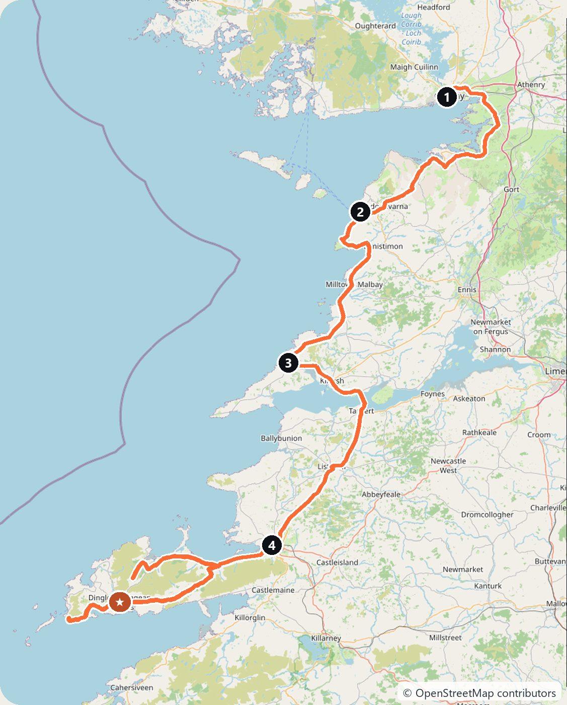
This stretch of Ireland’s Wild Atlantic Way — from Galway down to the Dingle Peninsula — packs limestone moonscapes, sea cliffs and tiny harbour villages into about 340 km. You drive on the left, the roads are often narrow and winding, and the coastal route is signed with the blue Wild Atlantic Way markers. Take it slow and pull into the passing places.
Day 1 — Galway to Doolin (75 km)
Leave Galway and cross the Burren, a vast karst landscape of bare grey limestone. Stop at Aillwee or the coast road, then settle in the trad-music village of Doolin for the night.
Day 2 — Cliffs of Moher to Loop Head (90 km)
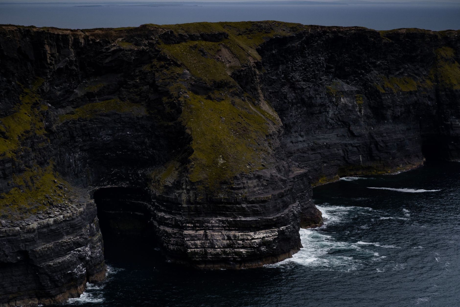
The Cliffs of Moher rise over 200 m straight from the Atlantic — go early to beat the crowds. Follow the coast south; if you have time, the quieter Loop Head peninsula is a lovely detour with a lighthouse. Sleep in Kilkee, at the start of the Loop Head peninsula.
Day 3 — Across the Shannon to Tralee (110 km)
Take the Killimer–Tarbert ferry across the Shannon Estuary (a short crossing that saves a long inland drive), then continue through Tralee towards the Dingle Peninsula.
Day 4 — Slea Head Drive and Dingle (65 km)
Drive the Slea Head Drive, a stunning loop around the tip of the peninsula past beehive huts and Blasket Island views. Finish in colourful Dingle town. The high Conor Pass is a spectacular but very narrow alternative route in — skip it in a large vehicle or bad weather.
Costs
Use the cost calculator to price fuel and nights for your exact dates. As a rough guide, budget for the short Shannon ferry fare and fuel for ~340 km; there are no motorway tolls on this coastal route (the tolled roads are around Dublin and Limerick). Book Dingle and Doolin beds early in summer, when the coast is busy.
This trip is also in the free Roadcut trip planner: change the number of days and where you sleep each night, pick your vehicle to see the fuel cost, check the weather on the road, and open each day in Google Maps, Apple Maps or Waze.
Where to stay on this route
Night by night, in the towns this itinerary sleeps in.
- Night 1Hotels in Doolin →
- Night 2Hotels in Kilkee →
- Night 3Hotels in Tralee →
The search opens with sample dates a month from today — change them to yours on Booking. Affiliate link — we may earn a commission at no extra cost to you.
The route on video
Get this itinerary by email
The days and the nights in your inbox, with a link back here when you are ready to book.
We use your address only to send this itinerary, unless you tick the box. Privacy
⚡ By electric car on this route
30 charging stations within 1.5 km of the road, 15 of them fast (DC). Most powerful: 200 kW.
Longest stretch without a fast charger tagged: 111 km, from km 267 of the route.
According to OpenStreetMap and operators’ websites. Fast = a DC plug or 50 kW and more; not every station has its power filled in, so there may be more. See them on the planner map → · EV charging →
🚦 Know before you go
Good to know
Good to know. This western route uses no motorway tolls and does not touch Dublin's M50, so the Galway-to-Dingle drive (including the Dingle Peninsula) is toll-free.
Estimate your exact costs in the cost calculator. Prices are approximate — check official sites before you travel. Some links are affiliate links.
Plan this trip
Where to sleep
Hotels & B&Bs →Holiday homes & apartments →Campsites (bookable) →Campervan & overnight spots →Tours & tickets
Find things to do →Affiliate link — we may earn a commission at no extra cost to you.
New road trips in your inbox
One email when we publish a new European route — the full guide, map and real costs. No spam, unsubscribe anytime.